Image:Mapofkanto.png
From Wikipedia, the free encyclopedia
No higher resolution available.
Mapofkanto.png (585 × 554 pixels, file size: 306 KB, MIME type: image/png)
| | This is a file from the Wikimedia Commons. The description on its description page there is shown below.
|
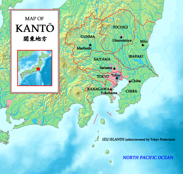
English: A map of the Kanto region in Japan with prefectures and their borders indicated. Made by the uploader. Map is based on a map taken from http://www.demis.nl/wms/mapclip.htm.
日本語: 関東地方の地図、http://www.demis.nl/wms/mapclip.htmから。
[edit] Licensing

| This image is in the public domain because came from the site http://www.demis.nl/home/pages/Gallery/examples.htm and was released by the copyright holder. Permission is granted to copy, distribute and/or modify this map since it is based on free of copyright images from: www.demis.nl. See also approval email on de.wp and its clarification. |
File history
Click on a date/time to view the file as it appeared at that time.
| Date/Time | Dimensions | User | Comment | |
|---|---|---|---|---|
| current | 18:39, 19 May 2007 | 585×554 (306 KB) | Tonym88 | (New version) |
| 20:24, 1 July 2006 | 627×581 (279 KB) | Tonym88 | (A map of the Kanto region in Japan with Prefectures and their borders indicated. Made by the uploader. Map is based on a map taken from http://www.demis.nl/wms/mapclip.htm. This is a duplicate image of Image:Kantomap.png. This image had to be create) |
File links
The following pages on the English Wikipedia link to this file (pages on other projects are not listed):

