Image:Map plate tectonics world.gif
From Wikipedia, the free encyclopedia
Size of this preview: 800 × 503 pixels
Full resolution (859 × 540 pixels, file size: 26 KB, MIME type: image/gif)
| | This is a file from the Wikimedia Commons. The description on its description page there is shown below.
|
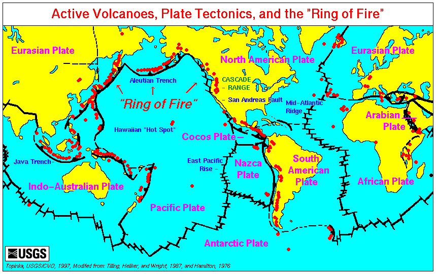
World map showing plate boundaries and active volcanoes.
Source: http://vulcan.wr.usgs.gov/Glossary/PlateTectonics/Maps/map_plate_tectonics_world.html
[edit] Licensing
| This image is in the public domain because it contains materials that originally came from the United States Geological Survey, an agency of the United States Department of Interior. For more information, see the official USGS copyright policy |
|
File history
Click on a date/time to view the file as it appeared at that time.
| Date/Time | Dimensions | User | Comment | |
|---|---|---|---|---|
| current | 00:43, 10 September 2007 | 859×540 (26 KB) | Avenue | (World map showing plate boundaries and active volcanoes. Source: http://vulcan.wr.usgs.gov/Glossary/PlateTectonics/Maps/map_plate_tectonics_world.html) |
File links
The following pages on the English Wikipedia link to this file (pages on other projects are not listed):

