Image:Map of Sveaborg at the 1790s.png
From Wikipedia, the free encyclopedia
Size of this preview: 348 × 599 pixels
Full resolution (374 × 644 pixels, file size: 27 KB, MIME type: image/png)
| | This is a file from the Wikimedia Commons. The description on its description page there is shown below.
|
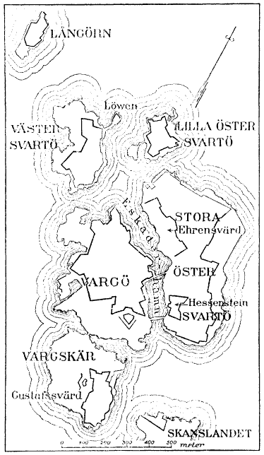
Map of Sveaborg at the 1790s.
From English Wikipedia: en:Image:Map of Sveaborg at the 1790s.png
Original source: Nordisk familjebok (1918), vol.27, p.882 [1]
|
English: This image was first published in 1st or 2nd edition of Nordisk familjebok (1904–1926). The copyrights for that book have expired and this image is in the public domain.
Svenska: Denna bild publicerades första gången i den första eller andra upplagan av Nordisk familjebok (1904–1926). Upphovsrätten för det verket har gått ut, och bilderna är fria att använda.
Deutsch: Dieses Bild stammt aus der ersten oder zweiten Version des Nordisk familjebok (1904–1926). Das Werk ist gemeinfrei.
Français : Cette image a été publiée dans la 1ère ou la 2ème édition du Nordisk familjebok (1904–1926). Les droits d'auteur sur cet ouvrage ont expiré et cette image se trouve par conséquent dans le domaine public.
|
 |
File history
Click on a date/time to view the file as it appeared at that time.
| Date/Time | Dimensions | User | Comment | |
|---|---|---|---|---|
| current | 20:25, 1 August 2005 | 374×644 (27 KB) | Tomisti | (Map of Sveaborg at the 1790s. From English Wikipedia: en:Image:Map of Sveaborg at the 1790s.png <br> Original source: Nordisk familjebok {{PD}} ) |
File links
The following pages on the English Wikipedia link to this file (pages on other projects are not listed):

