Image:Map of SWFC's early home grounds.png
From Wikipedia, the free encyclopedia
Size of this preview: 342 × 599 pixels
Full resolution (800 × 1,401 pixels, file size: 95 KB, MIME type: image/png)
| | This is a file from the Wikimedia Commons. The description on its description page there is shown below.
|
[edit] Summary
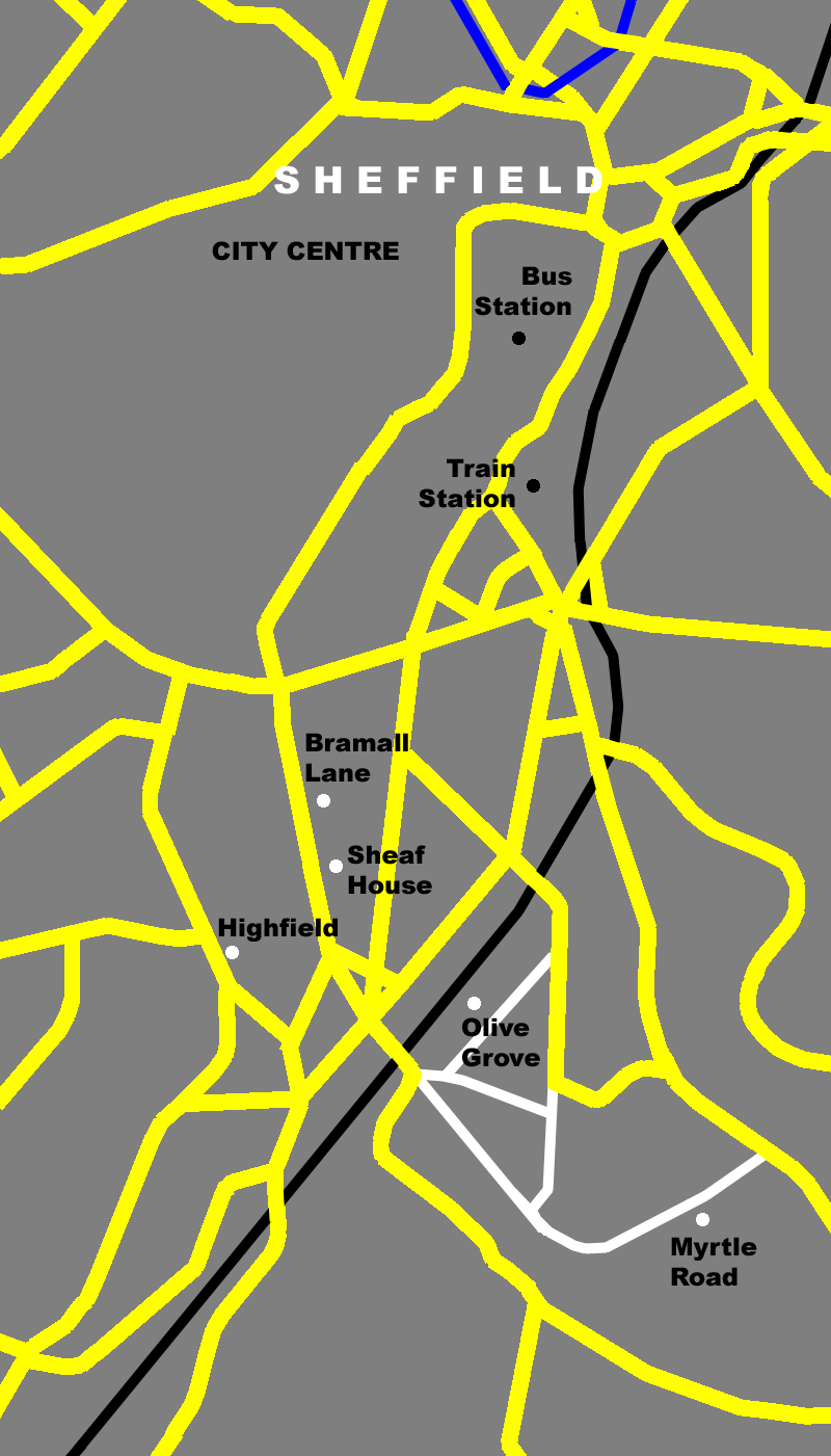
| Description |
Map of Bramall Lane area of Sheffield showing the location of early home grounds of 'The Wednesday' (Sheffield Wednesday F.C.) on a modern day map. |
|---|---|
| Source |
self-made |
| Date |
9 January 2008 |
| Author |
Daniel Bagshaw (Dan1980) |
| Permission (Reusing this image) |
see below |
| Other versions | This is Version 3: Corrected positioning of Myrtle Road and added Olive Grove Road and connecting streets Version 2: Filled in spaces in railway line Version 1: Original version |
[edit] Licensing

File history
Click on a date/time to view the file as it appeared at that time.
| Date/Time | Dimensions | User | Comment | |
|---|---|---|---|---|
| current | 16:09, 9 January 2008 | 800×1,401 (95 KB) | Dan1980 | (== Summary == {{Information |Description=Map of Bramall Lane area of Sheffield showing the location of early home grounds of 'The Wednesday' (Sheffield Wednesday F.C.) on a modern day map.<br>Featured on the map are (north to south) [[w:Pond Street bus st) |
| 20:03, 8 January 2008 | 800×1,401 (90 KB) | Dan1980 | (== Summary == {{Information |Description=Map of Bramall Lane area of Sheffield showing early home grounds of 'The Wednesday' (Sheffield Wednesday F.C.) |Source=self-made |Date=8 January 2008 |Author= Daniel Bagshaw (Dan1980) |Permission= ) | |
| 19:49, 8 January 2008 | 800×1,401 (91 KB) | Dan1980 | ({{Information |Description=Map of Bramall Lane area of Sheffield showing early home grounds of 'The Wednesday' (Sheffield Wednesday F.C.) |Source=self-made |Date=8 January 2008 |Author= Daniel Bagshaw (Dan1980) |Permission= |other_version) |
File links
The following pages on the English Wikipedia link to this file (pages on other projects are not listed):

