Image:Map of Rhode Island NA.png
From Wikipedia, the free encyclopedia
Size of this preview: 776 × 600 pixels
Full resolution (2,122 × 1,640 pixels, file size: 1,007 KB, MIME type: image/png)
| | This is a file from the Wikimedia Commons. The description on its description page there is shown below.
|
| Description |
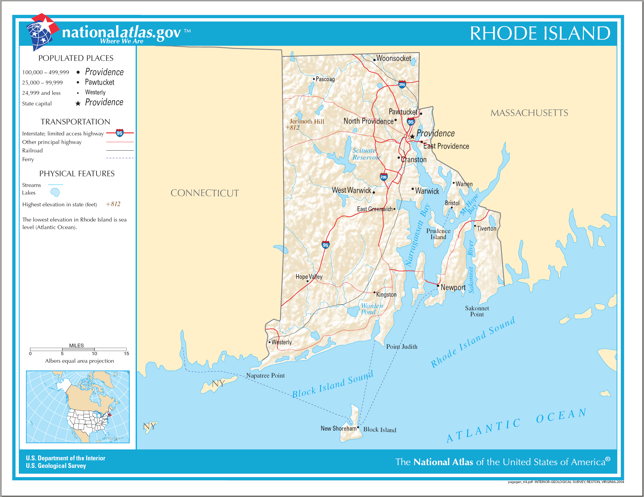
Map of Rhode Island |
|---|---|
| Source | |
| Date | |
| Author | |
| Permission (Reusing this image) |
see below |
| This map was obtained from an edition of the National Atlas of the United States. Like almost all works of the U.S. federal government, works from the National Atlas are in the public domain. Online access: NationalAtlas.gov | 1970 print edition: Library of Congress, Perry-Castañeda Library |
|
File history
Click on a date/time to view the file as it appeared at that time.
| Date/Time | Dimensions | User | Comment | |
|---|---|---|---|---|
| current | 08:22, 15 August 2006 | 2,122×1,640 (1,007 KB) | Huebi | ({{Information| |Description=Map of Rhode Island |Source=[http://www.nationalatlas.gov National Atlas] }} Category:Maps of the United States Category:Maps of Rhode Island {{PD-USGov-Atlas}}) |
File links
No pages on the English Wikipedia link to this file. (Pages on other projects are not counted.)

