Image:Map of Greene County Pennsylvania School Districts.png
From Wikipedia, the free encyclopedia
No higher resolution available.
Map_of_Greene_County_Pennsylvania_School_Districts.png (373 × 246 pixels, file size: 11 KB, MIME type: image/png)
| | This is a file from the Wikimedia Commons. The description on its description page there is shown below.
|
[edit] Summary
[edit] Summary
| Description |
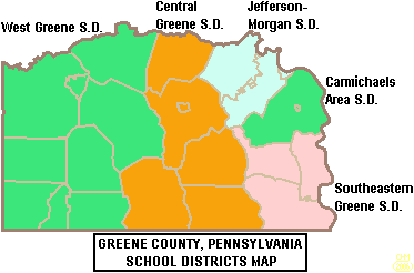
Map of Greene County, Pennsylvania, United States Public School Districts |
|---|---|
| Source |
taken from US Census website [1] and modified by User:Ruhrfisch |
| Date |
June 2006 |
| Author |
US Census, Ruhrfisch |
| Permission (Reusing this image) |
US Census / US Government work is public domain, my modifications licensed under the GNU Free Documentation License |
[edit] Licensing

File history
Click on a date/time to view the file as it appeared at that time.
| Date/Time | Dimensions | User | Comment | |
|---|---|---|---|---|
| current | 16:56, 12 June 2006 | 373×246 (11 KB) | Ruhrfisch | (== Summary == {{Information| |Description= Map of Greene County, Pennsylvania, United States Public School Districts |Source= taken from US Census website [http://factfinder.census.gov/] and modified by User:Ruhrfisch |Date= June 2006 |Author= US Ce) |
File links
The following pages on the English Wikipedia link to this file (pages on other projects are not listed):

