Image:Map of Europe (political).png
From Wikipedia, the free encyclopedia
Size of this preview: 800 × 523 pixels
Full resolution (1,596 × 1,043 pixels, file size: 108 KB, MIME type: image/png)
| | This is a file from the Wikimedia Commons. The description on its description page there is shown below.
|
 |
This map has been uploaded by Electionworld from en.wikipedia.org to enable the |
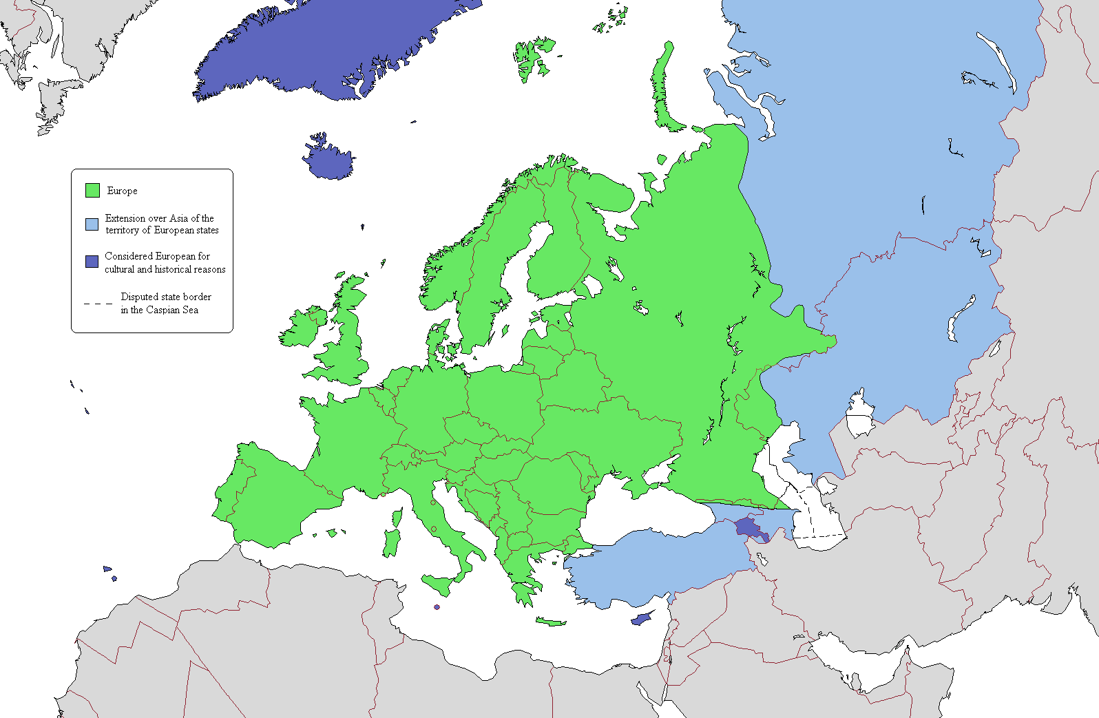
According to one common view of the boundary, the European continent is the area coloured green on this map. The light blue/dark blue colors are described here.
[edit] Licensing

[edit] Map Colors
Geographical Europe is colored green. The Asian territory of states that lie both in Europe and Asia are colored light blue. Dark-blue are colored states that lie entirely on the Asian continent, but are considered European because of religious, cultural and historical reasons. Azerbaijan's exclave of Nakhchivan is also coloured dark-blue because it is not a continuous extension of Azerbaijan's territory.
File history
Click on a date/time to view the file as it appeared at that time.
| Date/Time | Dimensions | User | Comment | |
|---|---|---|---|---|
| current | 21:02, 15 January 2007 | 1,596×1,043 (108 KB) | Jon Harald Søby | (small change in Azerbaijan's colour) |
| 14:06, 3 December 2006 | 1,596×1,043 (115 KB) | Electionworld | ({[ew|en|Alinor}} According to one common view of the boundary, the European continent is the area coloured green on this map. The light blue/dark blue colors are described at [[Transcontinental nation#Countries in both Asia and) |
File links
The following pages on the English Wikipedia link to this file (pages on other projects are not listed):
- Europe
- Copenhagen criteria
- User:Rashed
- Demographics of Europe
- List of countries spanning more than one continent
- User:Siyavash
- Wikipedia:Userboxes/Life
- User:Stolilv87
- User:Kenzilla
- User:Australian Jezza
- User:Saimdusan
- User:Cartoonmaster
- User:DanielEng
- Template:User Eurasian
- User:R13a
- User:Michaeldsuarez/more userboxes
- User:WiKID Daryl
- User:Royaljared
- User:Angelo De La Paz
- Talk:Georgia/Archive1
- Wikipedia:Userboxes/Ethnic groups
- User:Finlandlover
- User:Tweisbach
- User:Obaidz96/UBX
- User:Czar Choi
- User:Lenoxus/Public/Old


.png)