Image:Map of Allegheny County Pennsylvania With MtLebanon Highlighted.png
From Wikipedia, the free encyclopedia
Size of this preview: 624 × 599 pixels
Full resolution (815 × 783 pixels, file size: 112 KB, MIME type: image/png)
| | This is a file from the Wikimedia Commons. The description on its description page there is shown below.
|
[edit] Summary
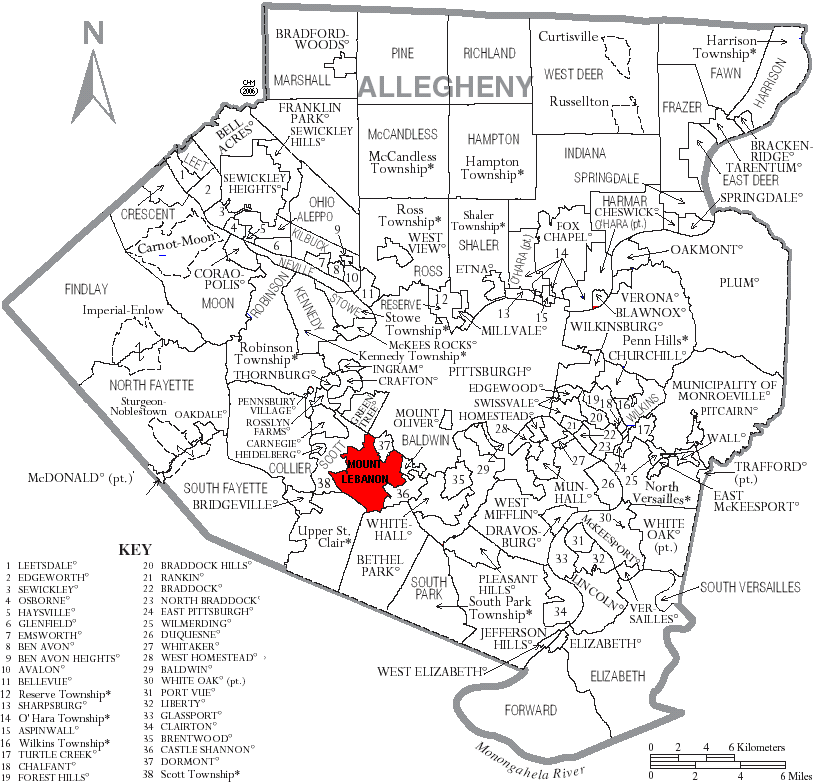
| Description |
Map of Allegheny County, Pennsylvania, United States with township and municipal boundaries |
|---|---|
| Source |
taken from US Census website [1] and modified by User:Ruhrfisch to make Image:Map_of_Allegheny_County_Pennsylvania_With_Municipal_and_Township_Labels.png; then modified again by User:Mareino |
| Date |
April 2006 |
| Author |
US Census, Ruhrfisch, Mareino |
| Permission (Reusing this image) |
US Census / US Government work is public domain, my modifications licensed under the GNU Free Documentation License |
[edit] Licensing

File history
Click on a date/time to view the file as it appeared at that time.
| Date/Time | Dimensions | User | Comment | |
|---|---|---|---|---|
| current | 22:54, 22 May 2006 | 815×783 (112 KB) | Mareino | ({{Information| |Description= Map of Allegheny County, Pennsylvania, United States with township and municipal boundaries |Source= taken from US Census website [http://www2.census.gov/geo/maps/general_ref/cousub_outline/cen2k_pgsz/pa_cosub.pdf] and modifi) |
File links
No pages on the English Wikipedia link to this file. (Pages on other projects are not counted.)

