Image:Map Phra Nakhon.png
From Wikipedia, the free encyclopedia
Size of this preview: 436 × 599 pixels
Full resolution (1,299 × 1,784 pixels, file size: 1 MB, MIME type: image/png)
| | This is a file from the Wikimedia Commons. The description on its description page there is shown below.
|
[edit] Summary
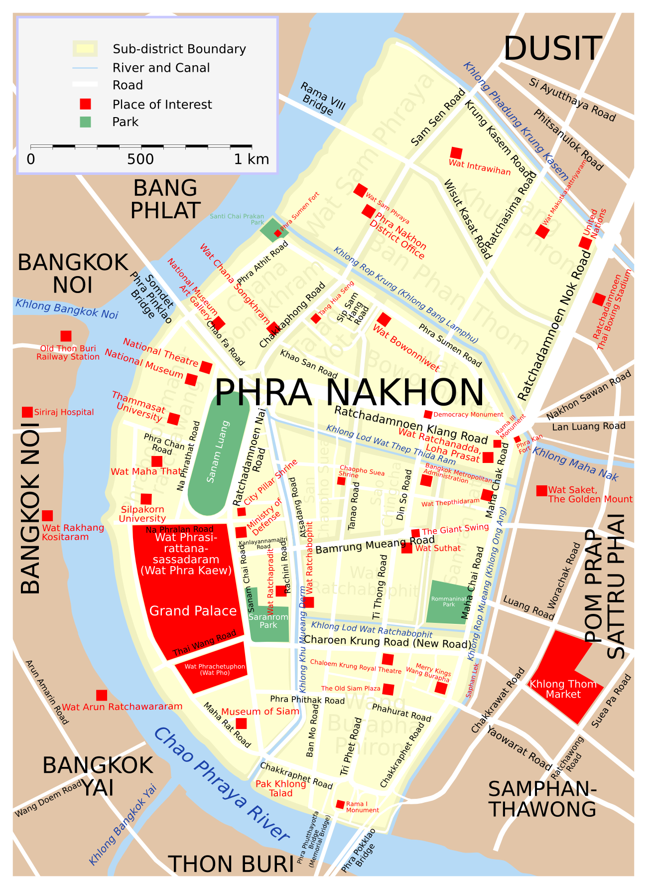
| Description |
Map of Phra Nakhon District, Bangkok. |
|---|---|
| Source |
Own creation |
| Date |
14 August 2006 |
| Author | |
| Permission (Reusing this image) |
GFDL |
| Other versions | Image:Map Phra Nakhon src eng.svg (SVG source) |
[edit] Licensing

File history
Click on a date/time to view the file as it appeared at that time.
| Date/Time | Dimensions | User | Comment | |
|---|---|---|---|---|
| current | 15:51, 9 October 2006 | 1,299×1,784 (1 MB) | Lerdsuwa | (Fix forts. Add more places of interest.) |
| 15:53, 20 August 2006 | 1,299×1,784 (1,000 KB) | Lerdsuwa | (Add Phra Sumen Fort. Fix khlong.) | |
| 17:23, 14 August 2006 | 1,299×1,784 (986 KB) | Lerdsuwa | ({{Information |Description=Map of Phra Nakhon District, Bangkok. |Source=Own creation |Date=14 August 2006 |Author=Lerdsuwa |Permission=GFDL |other_versions=Image:Map Phra Nakhon src eng.svg (SVG source) }} [[Category:Maps of Ba) |
File links
The following pages on the English Wikipedia link to this file (pages on other projects are not listed):

