Image:Map 1914 WWI Alliances.jpg
From Wikipedia, the free encyclopedia
Size of this preview: 759 × 599 pixels
Full resolution (1,682 × 1,328 pixels, file size: 615 KB, MIME type: image/jpeg)
| | This is a file from the Wikimedia Commons. The description on its description page there is shown below.
|
[edit] Summary
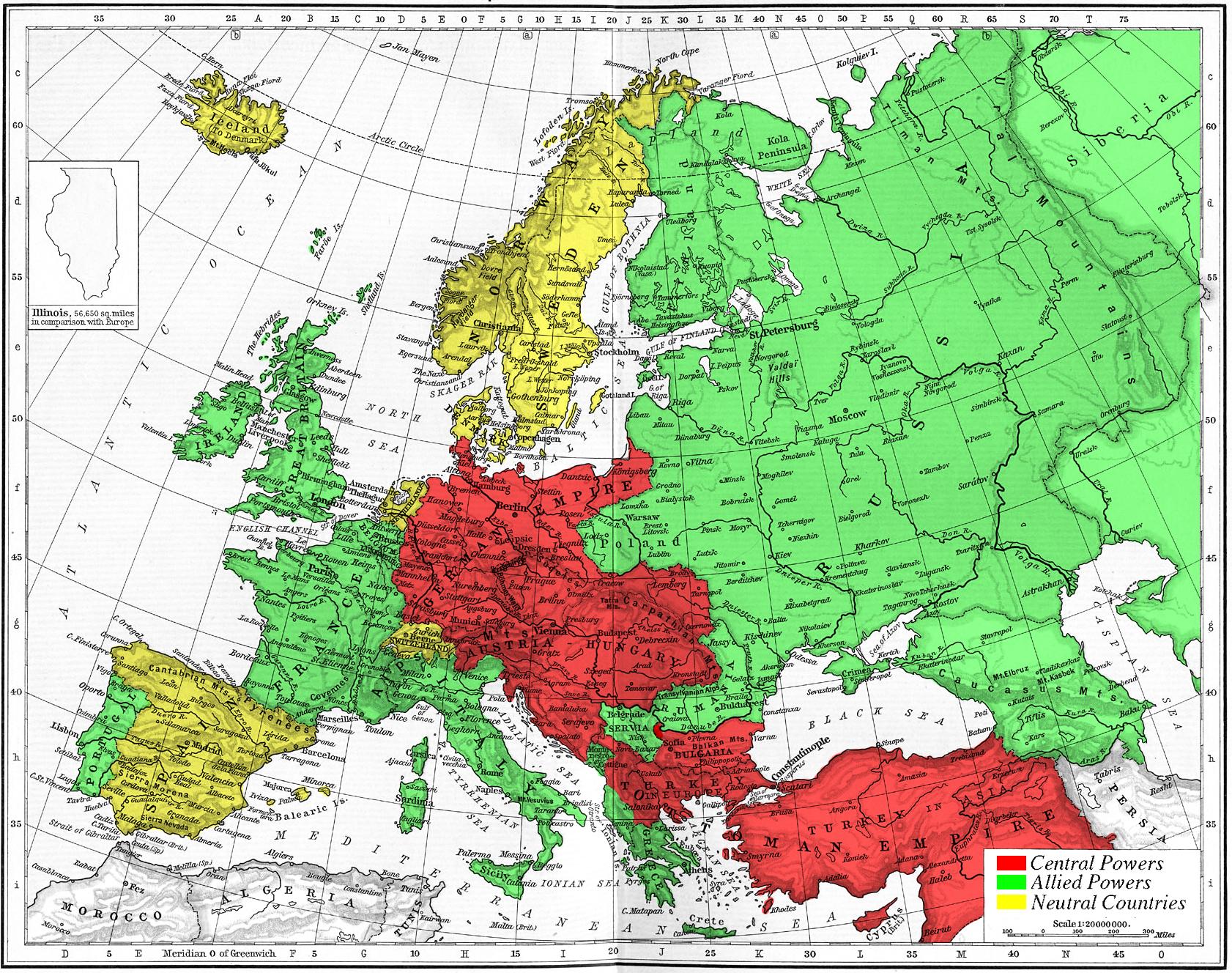
Map of Europe's alliances in 1915. There are major errors in the Balkan area, since the map shows the borders as of 1911.
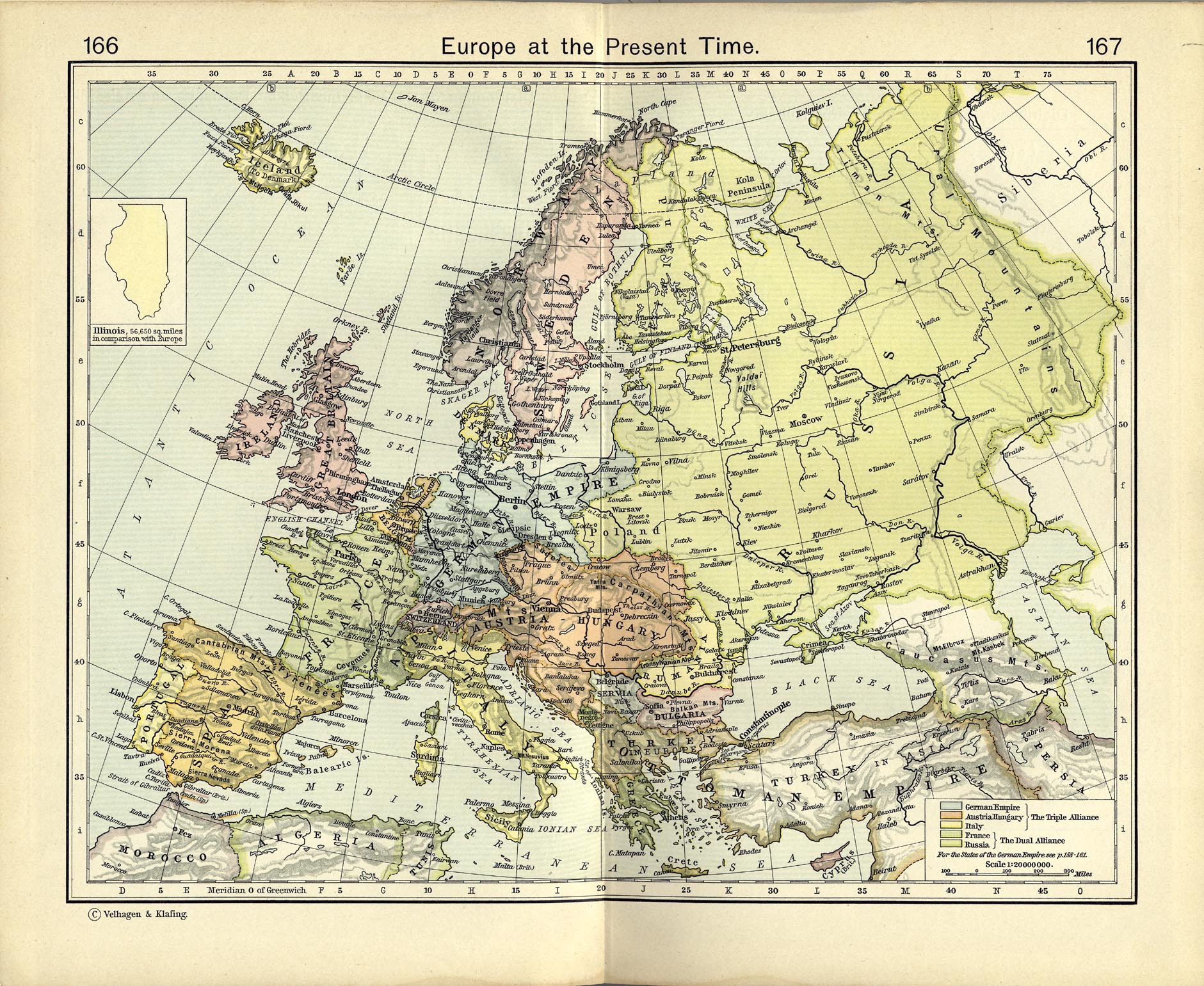
I, Carnildo, created this map from a map from William Shepard's 1911 Historical Atlas. The original map was downloaded from the University of Texas' Perry-Castañeda Library map collection, URL http://www.lib.utexas.edu/maps/historical/shepherd_1911/shepherd-c-166-167.jpg.
The GIMP-native image file for this image may be found at en:Image:Europe-WWI.xcf. It is recommended that anyone editing this map work with the .xcf version.
[edit] Licensing
| I, the copyright holder of this work, hereby release it into the public domain. This applies worldwide. In case this is not legally possible: Afrikaans | Alemannisch | Aragonés | العربية | Asturianu | Български | Català | Česky | Cymraeg | Dansk | Deutsch | Eʋegbe | Ελληνικά | English | Español | Esperanto | Euskara | Estremeñu | فارسی | Français | Galego | 한국어 | हिन्दी | Hrvatski | Ido | Bahasa Indonesia | Íslenska | Italiano | עברית | Kurdî / كوردی | Latina | Lietuvių | Latviešu | Magyar | Македонски | Bahasa Melayu | Nederlands | Norsk (bokmål) | Norsk (nynorsk) | 日本語 | Polski | Português | Ripoarisch | Română | Русский | Shqip | Slovenčina | Slovenščina | Српски / Srpski | Svenska | ไทย | Tagalog | Türkçe | Українська | Tiếng Việt | Walon | 中文(简体) | 中文(繁體) | zh-yue-hant | +/- |
File history
Click on a date/time to view the file as it appeared at that time.
| Date/Time | Dimensions | User | Comment | |
|---|---|---|---|---|
| current | 15:09, 6 November 2005 | 1,682×1,328 (615 KB) | Knutux | (Map of Europe's alliances in 1915. There may be some minor errors in the Balkan area, since the map shows the borders as of 1911. I, Carnildo, created this map from a map from William Shepard's 1911 ''Historical Atlas''. The o) |

