Image:Manila Bay with Mount Arayat.jpg
From Wikipedia, the free encyclopedia
Size of this preview: 800 × 554 pixels
Full resolution (803 × 556 pixels, file size: 206 KB, MIME type: image/jpeg)
| | This is a file from the Wikimedia Commons. The description on its description page there is shown below.
|
| Description |
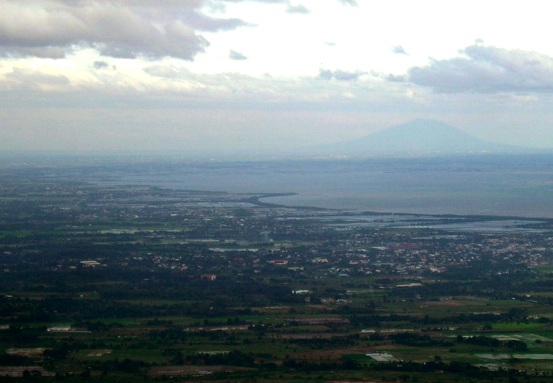
English: View in direction NNE from Mount Samat War Memorial, near Pilar, Bataan, Luzon Island, Philippines. – "At 555 meters above sea level, the viewing gallery at the arms of the memorial cross provides a panoramic view of the Central Plains of Luzon, the Manila Bay area, and the solitude of Mt. Arayat in the background."
Deutsch: Blick in Richtung NNO vom Mount Samat, nahe Pilar, Bataan, Insel Luzón, Philippinen. – Blick über die Zentralebene von Luzón, die Manilabucht, im Hintergrund der Vulkan Arayat.
|
|---|---|
| Source |
flickr.com (slightly edited: contrast, colours) |
| Date |
2005 |
| Author |
Shubert Ciencia, Nueva Ecija, Philippines |
| Permission (Reusing this image) |
CC-by-2.0 |
| This file is licensed under Creative Commons Attribution 2.0 License |
 |
This image, which was originally posted to Flickr, was reviewed on 05/02/2008 by the administrator or trusted user Nick, who confirmed that it was available on Flickr under the above license on that date. |
File history
Click on a date/time to view the file as it appeared at that time.
| Date/Time | Dimensions | User | Comment | |
|---|---|---|---|---|
| current | 10:48, 1 February 2008 | 803×556 (206 KB) | Überraschungsbilder | |
| 10:34, 1 February 2008 | 803×556 (208 KB) | Überraschungsbilder | ({{Information |Description={{View in direction NNE from en:Mount Samat War Memorial, near Pilar, Bataan, Luzon Island, Philippines. – "At 555 meters above sea level, the viewing gallery at the arms of the memorial cross provides a pa) |
File links
The following pages on the English Wikipedia link to this file (pages on other projects are not listed):

