Image:Magadan 1978.jpg
From Wikipedia, the free encyclopedia
Size of this preview: 513 × 599 pixels
Full resolution (746 × 871 pixels, file size: 184 KB, MIME type: image/jpeg)
| | This is a file from the Wikimedia Commons. The description on its description page there is shown below.
|
La bildo estas kopiita de wikipedia:en. La originala priskribo estas:
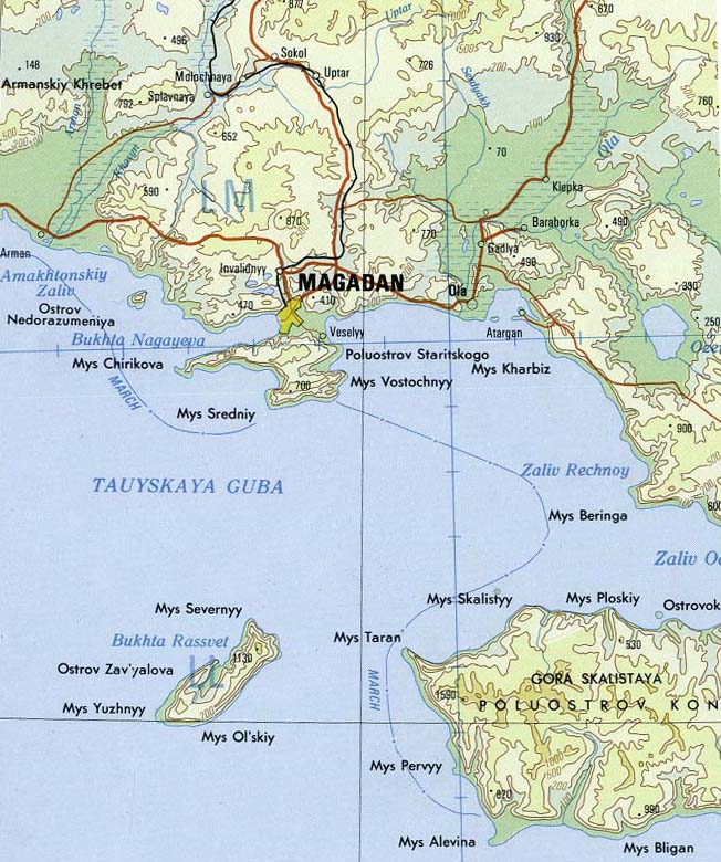
Subject: Magadan area of far east Russia
Source: Portion of Magadan sheet. Topographic Map NO 56, Series 1301. Original Scale 1:1,000,000. Printed by U.S. Defense Mapping Agency Topographic Center, 1978. From the PCL map collection, courtesy of the University of Texas Libraries, The University of Texas at Austin.[1]
| This image is a work of a U.S. military or Department of Defense employee, taken or made during the course of an employee's official duties. As a work of the U.S. federal government, the image is in the public domain. See the DoD copyright policy. |
 |
| date/time | username | edit summary |
|---|---|---|
| 14:47, 21 January 2005 | en:User:Neutrality | ({{PD-USGov-Military}}) |
| 18:51, 18 January 2005 | en:User:Kbh3rd | (credit) |
| 18:41, 18 January 2005 | en:User:Kbh3rd | (Source info) |
| 18:35, 18 January 2005 | en:User:Kbh3rd | (Magadan area of far east Russia {{PD-USGov}}) |
[edit] Historio de la dosiero
Legend: (cur) = this is the current file, (del) = delete this old version, (rev) = revert to this old version.
Click on date to download the file or see the image uploaded on that date.
- (del) (cur) 18:35, 18 January 2005 . . en:User:Kbh3rd Kbh3rd ( en:User_talk:Kbh3rd Talk) . . 746x871 (188851 bytes) (Magadan area of far east Russia { { PD-USGov } })Category:マガダン
Category:Магадан Category:Urboj de Rusio Category:Magadana provinco Category:Miasta Rosji Category:ロシアの都市 Category:Ort in Russland Category:Ort mit Seehafen Category:Dalekoistočni savezni okrug Category:Gradovi u Rusiji Category:Города России Category:Порты России Category:Порты Тихого океана Category:Населённые пункты Магаданской области
File history
Click on a date/time to view the file as it appeared at that time.
| Date/Time | Dimensions | User | Comment | |
|---|---|---|---|---|
| current | 19:16, 4 March 2006 | 746×871 (184 KB) | Maksim | (La bildo estas kopiita de wikipedia:en. La originala priskribo estas: '''Subject''': Magadan area of far east Russia '''Source''': Portion of Magadan sheet. Topographic Map NO 56, Series 1301. Original Scale 1:1,000,000. Printed by U.S. Defense Mapping ) |

