Image:México División Política-1824.png
From Wikipedia, the free encyclopedia
Size of this preview: 557 × 599 pixels
Full resolution (1,098 × 1,181 pixels, file size: 296 KB, MIME type: image/png)
| | This is a file from the Wikimedia Commons. The description on its description page there is shown below.
|
| Description |
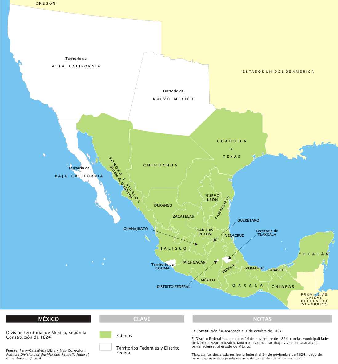
Español: División territorial de México en 1824, con notas en español.
|
||
|---|---|---|---|
| Source |
Trabajo propio |
||
| Date |
28 de marzo de 2006 |
||
| Author |
Yavidaxiu |
||
| Permission (Reusing this image) |
|
File history
Click on a date/time to view the file as it appeared at that time.
| Date/Time | Dimensions | User | Comment | |
|---|---|---|---|---|
| current | 17:33, 28 March 2007 | 1,098×1,181 (296 KB) | Yavidaxiu | ({{Information |Description={{es|División territorial de México en 1824, con notas en español.}} |Source=Trabajo propio |Date=28 de marzo de 2006 |Author=Yavidaxiu |Permission={{PD-self}} |other_versions= }} Category:Maps of Mexico) |

