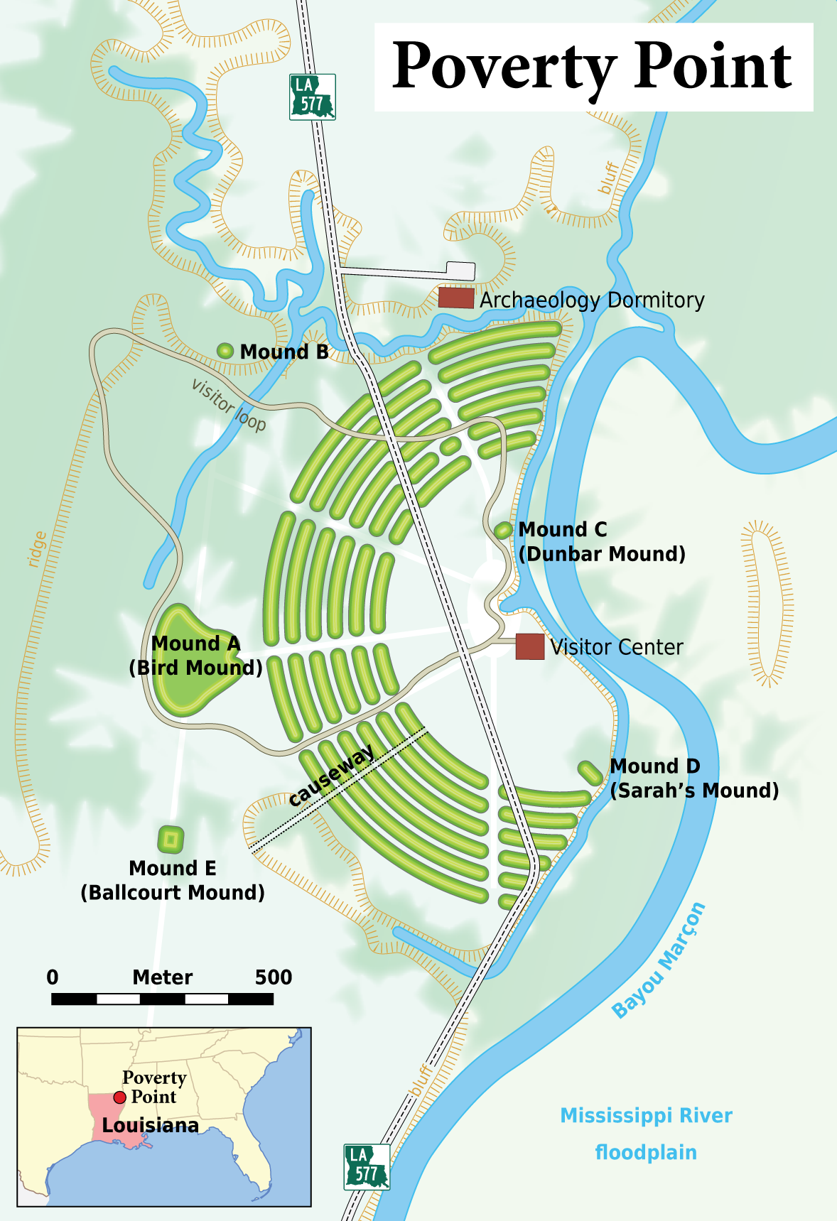
Image:Louisiana - Poverty Point - Karte (English version).png
From Wikipedia, the free encyclopedia
Size of this preview: 411 × 600 pixels
Full resolution (1,178 × 1,719 pixels, file size: 762 KB, MIME type: image/png)
| | This is a file from the Wikimedia Commons. The description on its description page there is shown below.
|
| Description |
|
|||
|---|---|---|---|---|
| Source |
Self made, using the following files: The map contents are based on the follwowing informations:
Many thanks to h-stt who provided me with all these links!
Deutsch: Diese Karte wurde als Kartenwunsch in die Kartenwerkstatt eingebracht. Auch du kannst bei uns neue Kartenwünsche einbringen. |
|||
| Date |
April 2008 |
|||
| Author | ||||
| Permission (Reusing this image) |
Sie dürfen das Bild zu den folgenden Bedingungen nutzen:
|
|||
| Other versions |
|


File history
Click on a date/time to view the file as it appeared at that time.
| Date/Time | Dimensions | User | Comment | |
|---|---|---|---|---|
| current | 17:45, 13 April 2008 | 1,178×1,719 (762 KB) | Chumwa | (Bayou Maçon -> Bayou Marçon) |
| 16:17, 13 April 2008 | 1,178×1,719 (760 KB) | Chumwa | ({{Information |Description= *{{ de }} Karte: Übersicht über die archäologische Stätte von Poverty Point (Louisiana) *{{ en }} Map of the Poverty Point archaeological site |Source=Self made, using the following files: *[[:Image:Map_of_USA_LA.svg|orient) |
File links
The following pages on the English Wikipedia link to this file (pages on other projects are not listed):


.png)