Image:Long-beach-island-map-with-locales.png
From Wikipedia, the free encyclopedia
No higher resolution available.
Long-beach-island-map-with-locales.png (580 × 580 pixels, file size: 48 KB, MIME type: image/png)
| | This is a file from the Wikimedia Commons. The description on its description page there is shown below.
|
[edit] Summary
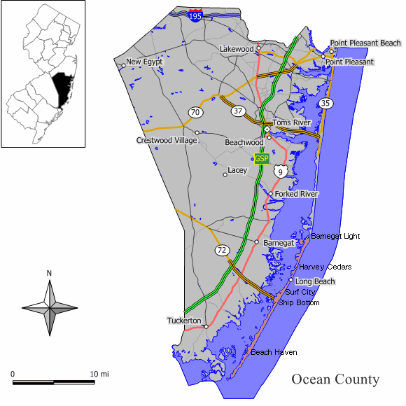
Position of Long Beach Island relative to Ocean County, NJ, with locale names. Derived from Image:Long-beach-island-map.png
[edit] Licensing

File history
Click on a date/time to view the file as it appeared at that time.
| Date/Time | Dimensions | User | Comment | |
|---|---|---|---|---|
| current | 01:13, 19 August 2006 | 580×580 (48 KB) | Brianski | (Position of Long Beach Island relative to Ocean County, NJ, with locale names. Derived from Image:Long-beach-island-map.png) |
File links
The following pages on the English Wikipedia link to this file (pages on other projects are not listed):

