Image:LocMap-Black-Hills-SD.png
From Wikipedia, the free encyclopedia
No higher resolution available.
LocMap-Black-Hills-SD.png (280 × 183 pixels, file size: 15 KB, MIME type: image/png)
[edit] Summary
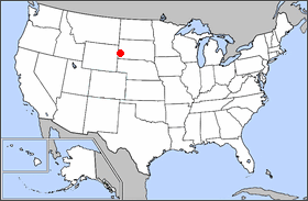
Location map of the Black Hills, for Mount Rushmore National Memorial, Jewel Cave National Monument, and Wind Cave National Park. Adapted from Image:Map of USA Locator blank.png, GNU FDL image.
[edit] Licensing
 |
Permission is granted to copy, distribute and/or modify this document under the terms of the GNU Free Documentation License, Version 1.2 or any later version published by the Free Software Foundation; with no Invariant Sections, no Front-Cover Texts, and no Back-Cover Texts. Subject to disclaimers. |
File history
Click on a date/time to view the file as it appeared at that time.
| Date/Time | Dimensions | User | Comment | |
|---|---|---|---|---|
| current | 18:41, 22 September 2005 | 280×183 (15 KB) | Eoghanacht (Talk | contribs) | (Location map of the Black Hills, for Mount Rushmore National Memorial, Jewel Cave National Monument, and Wind Cave National Park. Adapted from Image:Map of USA Locator blank.png, GNU FDL image.) |
- Search for duplicate files
- Edit this file using an external application
See the setup instructions for more information.
File links
The following pages on the English Wikipedia link to this file (pages on other projects are not listed):

