Image:Lasvegasairportmap.png
From Wikipedia, the free encyclopedia
Size of this preview: 600 × 600 pixels
Full resolution (2,550 × 2,550 pixels, file size: 741 KB, MIME type: image/png)
| | This is a file from the Wikimedia Commons. The description on its description page there is shown below.
|
[edit] Summary
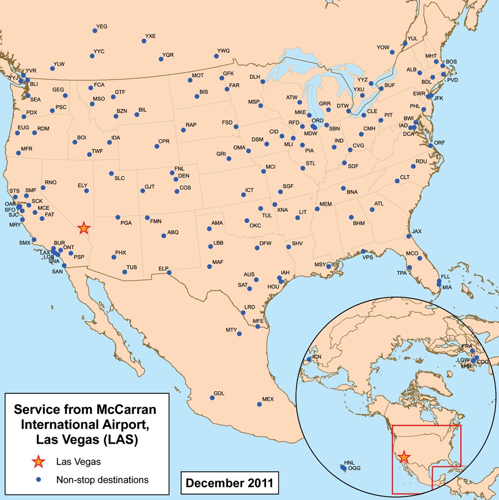
This is a route map for McCarran International Airport serving Las Vegas as of February 2007. Map is an Azimuthal equidistant projection centered on the airport so straight lines from Las Vegas are along great circle routes. Source.
[edit] Licensing
|
File history
Click on a date/time to view the file as it appeared at that time.
| Date/Time | Dimensions | User | Comment | |
|---|---|---|---|---|
| current | 19:46, 8 May 2007 | 2,550×2,550 (741 KB) | Kmusser | (Correction, removed some airports.) |
| 21:04, 27 February 2007 | 2,550×2,550 (745 KB) | Kmusser | (== Summary == This is a route map for en:McCarran International AirportMcCarran International Airport serving Las Vegas as of February 2007. Map is an [[:en:Azimuthal equidistant projection|Azimuthal equidistant projection]) |
File links
The following pages on the English Wikipedia link to this file (pages on other projects are not listed):

