Image:LAR ga map.png
From Wikipedia, the free encyclopedia
Size of this preview: 800 × 309 pixels
Full resolution (2,200 × 850 pixels, file size: 658 KB, MIME type: image/png)
| | This is a file from the Wikimedia Commons. The description on its description page there is shown below.
|
[edit] Summary
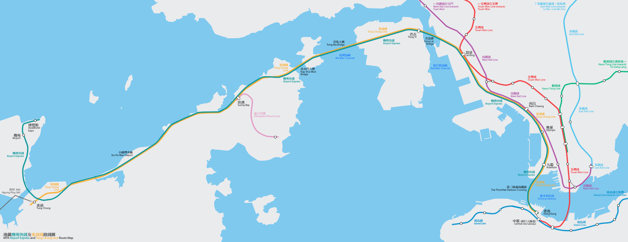
港鐵機場快綫及東涌綫路線圖(按真實地形繪畫) Geographically accurate map of the MTR Airport Express and Tung Chung Line
By Bus_28a, Mtrkwt

File history
Click on a date/time to view the file as it appeared at that time.
| Date/Time | Dimensions | User | Comment | |
|---|---|---|---|---|
| current | 08:25, 3 December 2007 | 2,200×850 (658 KB) | Mtrkwt | |
| 06:42, 28 January 2007 | 2,200×850 (500 KB) | Mtrkwt | ||
| 10:07, 26 February 2006 | 2,200×850 (496 KB) | Mtrkwt | (Geographically accurate map of the MTR Airport Express and Tung Chung Line) | |
| 19:44, 25 February 2006 | 2,200×850 (492 KB) | Mtrkwt | (地鐵機場快綫及東涌綫路線圖路線圖(按真實地形繪畫)) | |
| 19:34, 25 February 2006 | 2,200×850 (493 KB) | Mtrkwt | (地鐵機場快綫及東涌綫路線圖(按真實地形繪畫)) |
File links
The following pages on the English Wikipedia link to this file (pages on other projects are not listed):

