Image:LangfordYellowstoneLakeMap.JPG
From Wikipedia, the free encyclopedia
Size of this preview: 517 × 599 pixels
Full resolution (653 × 757 pixels, file size: 113 KB, MIME type: image/jpeg)
| | This is a file from the Wikimedia Commons. The description on its description page there is shown below.
|
[edit] Summary
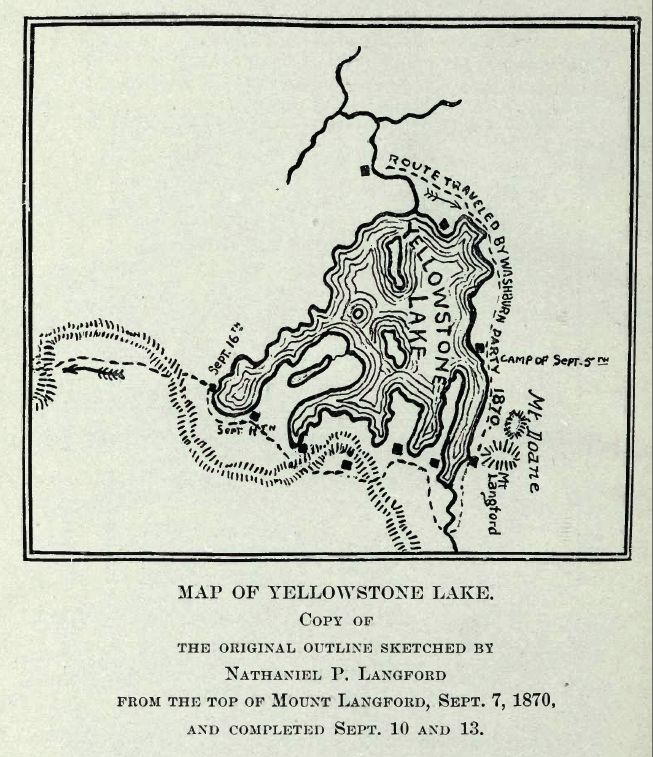
| Description |
Map of Yellowstone Lake, 1870 Washburn, Doane and Langford Expedition |
|---|---|
| Source |
Extracted from Public Domain PDF File of DIARY OF THE WASHBURN EXPEDITION TO THE YELLOWSTONE AND FIREHOLE RIVERS IN THE YEAR 1870 BY NATHANIEL PITT LANGFORD (1905), on the Internet Archive |
| Date |
February 2008 |
| Author |
Mike Cline |
| Permission (Reusing this image) |
see below |
[edit] Licensing
|
|
This media file is in the public domain in the United States. This applies to U.S. works where the copyright has expired, often because its first publication occurred prior to January 1, 1923. See this page for further explanation.
|
|
|
Deutsch | English | Español | Français | Gaeilge | Galego | Italiano | Nederlands | 中文(简体) | +/- |
||
|
|
This image might not be in the public domain outside of the United States (this especially applies in Canada, China (not Hong Kong, Macao, or Taiwan Area), Germany, Mexico, and Switzerland). The creator and year of publication are essential information and must be provided. See Wikipedia:Public domain and Wikipedia:Copyrights for more details. |
File history
Click on a date/time to view the file as it appeared at that time.
| Date/Time | Dimensions | User | Comment | |
|---|---|---|---|---|
| current | 01:53, 12 February 2008 | 653×757 (113 KB) | Mike Cline | ({{Information |Description=Map of Yellowstone Lake, 1870 Washburn, Doane and Langford Expedition |Source=Extracted from Public Domain PDF File of DIARY OF THE WASHBURN EXPEDITION TO THE YELLOWSTONE AND FIREHOLE RIVERS IN THE YEAR 1870 BY NATHANIEL PITT LA) |
File links
The following pages on the English Wikipedia link to this file (pages on other projects are not listed):

