Image:Lake Borgne de la Tour map 1720.jpg
From Wikipedia, the free encyclopedia
No higher resolution available.
Lake_Borgne_de_la_Tour_map_1720.jpg (656 × 547 pixels, file size: 249 KB, MIME type: image/jpeg)
| | This is a file from the Wikimedia Commons. The description on its description page there is shown below.
|
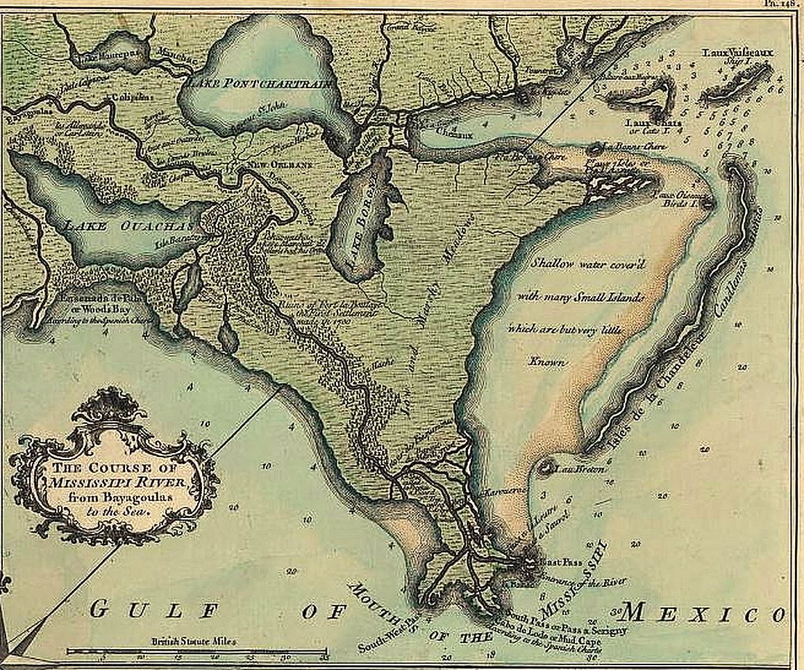
Detail of the map from the de la Tour survey of 1720 as published in 1759, showing the New Orleans area with Lake Borgne, Lake Pontchartrain Basin, and lower Missisissippi River.
Copyright expired.
Related Image: Image:New Orleans de la Tour map 1720 1759.jpg Full published version of De la Tour survey map
[edit] Licensing
| This image (or other media file) is in the public domain because its copyright has expired. This applies to the United States, Canada, the European Union and those countries with a copyright term of life of the author plus 70 years.
العربية | Asturianu | Български | Català | Česky | Dansk | Deutsch | English | Ελληνικά | Esperanto | Español | Euskara | فارسی | Français | Gaeilge | Galego | עברית | हिन्दी | Bahasa Indonesia | Italiano | 日本語 | 한국어 | Kurdî / كوردی | Lietuvių | Magyar | Nederlands | Norsk (nynorsk) | Bahasa Melayu | Polski | Português | Română | Русский | Slovenčina | Slovenščina | Shqip | Suomi | Sámegiella | Türkçe | 中文(简体) | 中文(繁體) | 粵語 | +/- |
File history
Click on a date/time to view the file as it appeared at that time.
| Date/Time | Dimensions | User | Comment | |
|---|---|---|---|---|
| current | 16:34, 9 May 2006 | 656×547 (249 KB) | Infrogmation | (Detail of the map from the de la Tour survey of 1720 as published in 1759, showing the New Orleans area with Lake Borgne, Lake Pontchartrain Basin, and lower Missisissippi River. Copyright expired. Category:Lake Pontchartrain [[Category:Maps of ) |
File links
Metadata
This file contains additional information, probably added from the digital camera or scanner used to create or digitize it. If the file has been modified from its original state, some details may not fully reflect the modified file.
| Orientation | Normal |
|---|---|
| Horizontal resolution | 72 dpi |
| Vertical resolution | 72 dpi |
| Software used | QuickTime 6.5 |
| File change date and time | 11:29, 9 May 2006 |
| Y and C positioning | 1 |

