Image:Lake Athabasca, Canada.jpg
From Wikipedia, the free encyclopedia
Size of this preview: 800 × 338 pixels
Full resolution (1,156 × 488 pixels, file size: 173 KB, MIME type: image/jpeg)
| | This is a file from the Wikimedia Commons. The description on its description page there is shown below.
|
[edit] Summary
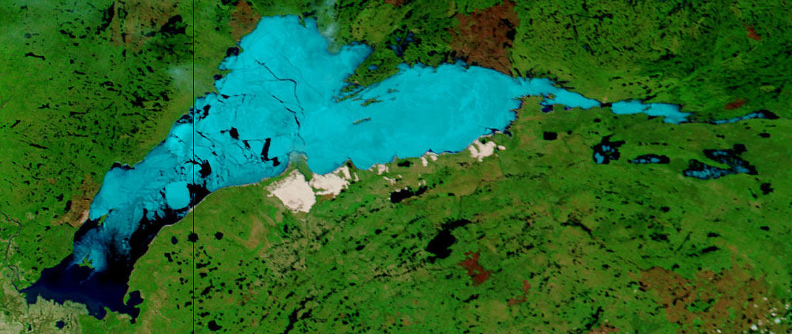
| Description |
Lake Athabasca, Canada. Lake Athabasca straddles the border between Alberta (west) and Saskatchewan (east) - the black line. In the false-color image, vegetation is green, water is dark blue, and ice (or snow) is light blue. |
|---|---|
| Source | |
| Date |
Visualization Date: 2002-06-18 |
| Author |
Jacques Descloitres, MODIS Land Rapid Response Team, NASA/GSFC |
| Permission (Reusing this image) |
see below |
Cropped from the original 4800 x 3600 JPEG (4.4MB) image.
[edit] Licensing
|
|
This file is in the public domain because it was created by NASA. NASA copyright policy states that "NASA material is not protected by copyright unless noted". (NASA copyright policy page or JPL Image Use Policy).
Deutsch | English | Español | Français | Nederlands | Português | Русский | 中文(简体) | 中文(繁體) | +/- |
|
 |
Warnings:
|
File history
Click on a date/time to view the file as it appeared at that time.
| Date/Time | Dimensions | User | Comment | |
|---|---|---|---|---|
| current | 11:37, 18 August 2006 | 1,156×488 (173 KB) | Feydey | ({{Information |Description= Lake Athabasca, Canada. Lake Athabasca straddles the border between Alberta (west) and Saskatchewan (east) - the black line. In the false-color image, vegetation is green, water is dark blue, and ice (or snow) is light blue. |S) |
File links
The following pages on the English Wikipedia link to this file (pages on other projects are not listed):

