Image:Kurzemes un Zemgales hercogiste 1740 locator.svg
From Wikipedia, the free encyclopedia

Kurzemes_un_Zemgales_hercogiste_1740_locator.svg (SVG file, nominally 984 × 738 pixels, file size: 183 KB)
| | This is a file from the Wikimedia Commons. The description on its description page there is shown below.
|
Contents |
[edit] Summary
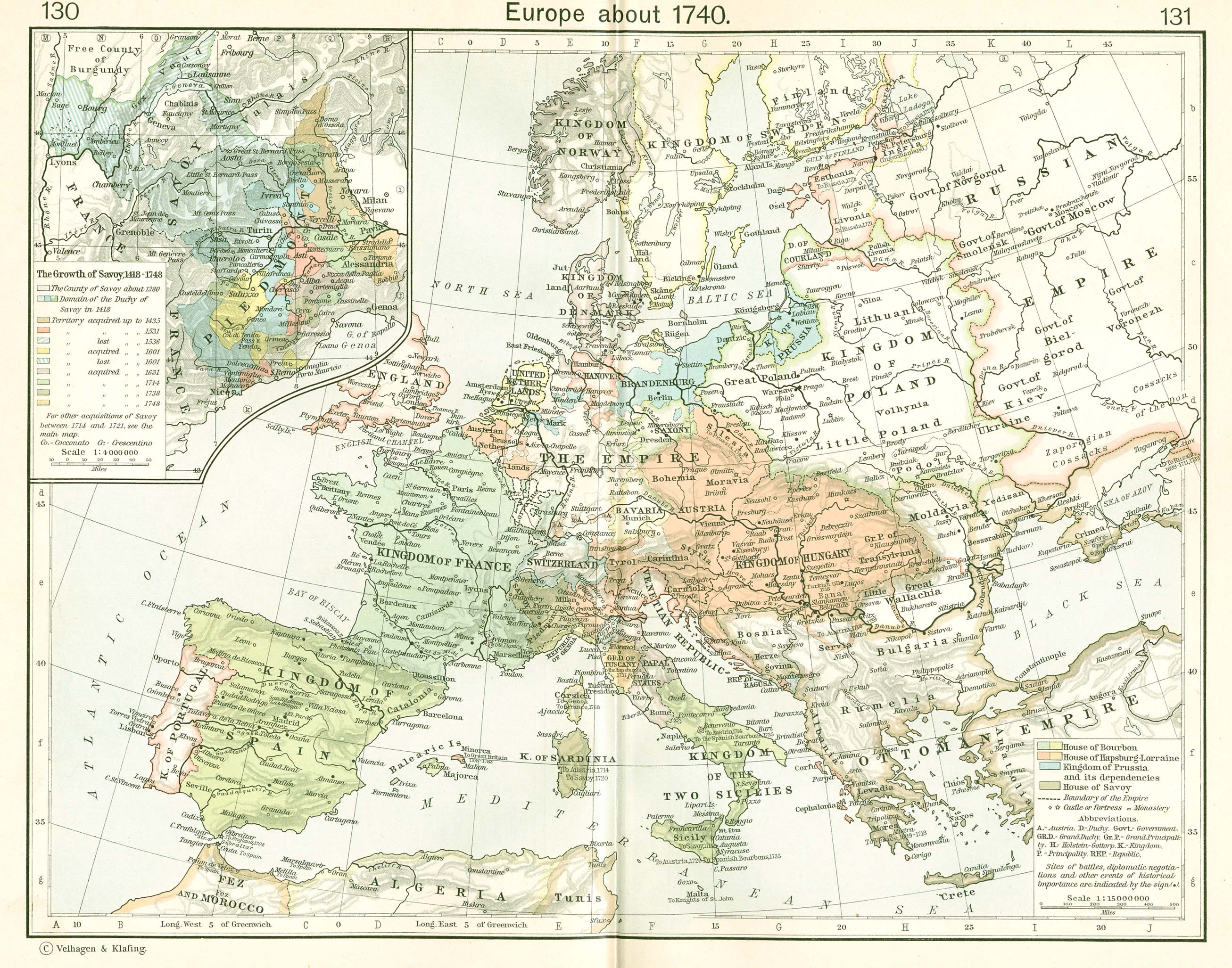
lv: Kurzemes un Zemgales Hercogiste 1740.
en: The Duchy of Courland and Semigallia in 1740.
The towns and cities are designated by their German names since the nobility and the Duke were of German heritage. The rivers, somewhat incongruously, are given their common Latvian names.
[edit] References
The basic map was developed from Shepherd:
- Shepherd, William R., (1911), "Europe, 1740" in Historical Atlas, p. 131.
Modifications were made based on other resources including:
- Hammond Historical World Atlas, Hammond World Atlas Corporation, (2000).
[edit] Other versions
- no text
- English language
- Latvian language
[edit] Licensing

File history
Click on a date/time to view the file as it appeared at that time.
| Date/Time | Dimensions | User | Comment | |
|---|---|---|---|---|
| current | 23:01, 24 January 2007 | 984×738 (183 KB) | MapMaster | (Kurzemes un Zemgales hercogiste, 1740 ) |
File links
The following pages on the English Wikipedia link to this file (pages on other projects are not listed):

