Image:KLEX USGS Comair Paths.jpg
From Wikipedia, the free encyclopedia
Size of this preview: 553 × 599 pixels
Full resolution (3,600 × 3,900 pixels, file size: 2.42 MB, MIME type: image/jpeg)
| | This is a file from the Wikimedia Commons. The description on its description page there is shown below.
|
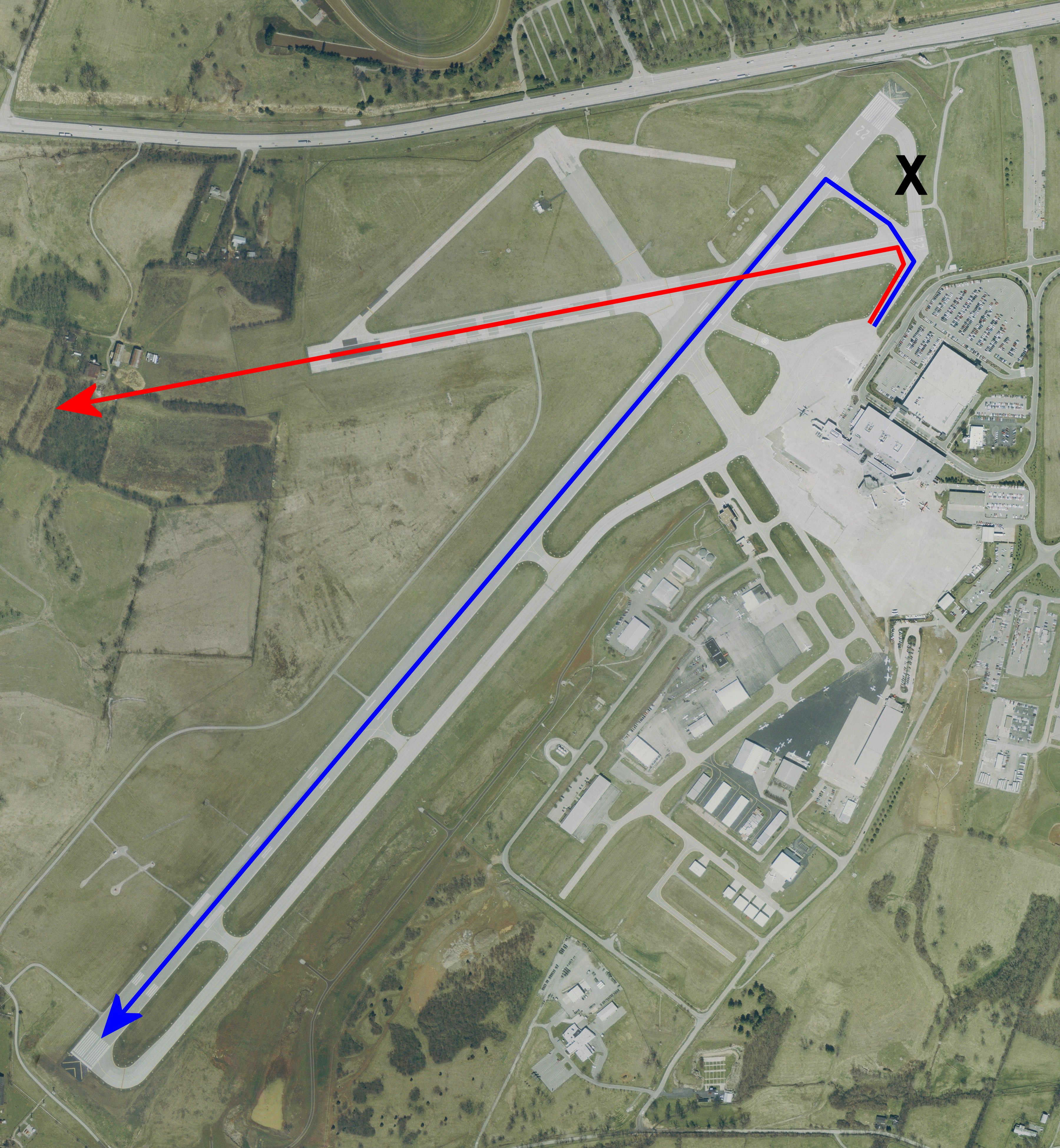
| Description | USGS urban ortho of Blue Grass Airport, Kentucky, USA. Overlayed with intended route vs actual route and approx crash site. X denotes the taxiway that was closed following recent construction.
██ Desired path via Rwy 22 ██ Actual path via Rwy 26, ending at approximate crash site. X marks the closed taxiway |
|||
|---|---|---|---|---|
| Source |
Extracted via USA Photomaps software |
|||
| Date |
Base map, April 2, 2002 |
|||
| Author |
Path data is approximate and was overlayed by Dual Freq on top of PD original. |
|||
| Permission (Reusing this image) |
|
|||
| Other versions | Image:KLEX Blue Grass Airport.jpg Full sized original |
File history
Click on a date/time to view the file as it appeared at that time.
| Date/Time | Dimensions | User | Comment | |
|---|---|---|---|---|
| current | 23:45, 29 August 2006 | 3,600×3,900 (2.42 MB) | Dual Freq | (Revised to show larger lines and full length of 22) |
| 20:40, 29 August 2006 | 3,800×2,600 (1.7 MB) | Dual Freq | ({{Information |Description=USGS urban ortho of Blue Grass Airport, Kentucky, USA. Overlayed with intended route vs actual route and approx crash site. |Source=Extracted via USA Photomaps software |Date=B) |
File links
The following pages on the English Wikipedia link to this file (pages on other projects are not listed):

