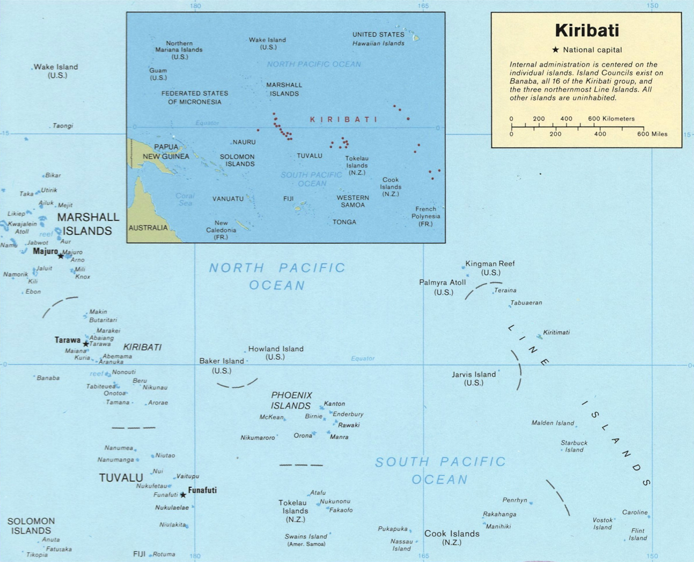
Image:Kiribati map LOC.jpg
From Wikipedia, the free encyclopedia
Size of this preview: 736 × 600 pixels
Full resolution (2,417 × 1,969 pixels, file size: 447 KB, MIME type: image/jpeg)
| | This is a file from the Wikimedia Commons. The description on its description page there is shown below.
|
| Description | ||||
|---|---|---|---|---|
| Source | ||||
| Date | ||||
| Author |
US Dept of Congress, 1989 |
|||
| Permission (Reusing this image) |
|

File history
Click on a date/time to view the file as it appeared at that time.
| Date/Time | Dimensions | User | Comment | |
|---|---|---|---|---|
| current | 03:52, 19 January 2008 | 2,417×1,969 (447 KB) | Indolences | ({{Information |Description= ''English'': Map of Kiribati ''Español'': Mapa de Kiribati |Source= ru:Изображение:Карта Кирибати.svg |Date= |Author= US Dept of Congress, 1989 |Permission= {{PD-USGo) |
File links
The following pages on the English Wikipedia link to this file (pages on other projects are not listed):

