Image:Keystone-map.png
From Wikipedia, the free encyclopedia
Size of this preview: 800 × 415 pixels
Full resolution (1,346 × 699 pixels, file size: 887 KB, MIME type: image/png)
| | This is a file from the Wikimedia Commons. The description on its description page there is shown below.
|
[edit] Summary
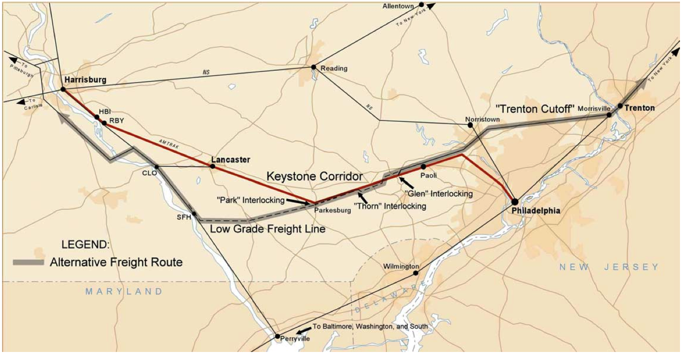
Description: Map of Amtrak's Keystone Corridor
Source: Technical Monograph: Transportation Planning for the Philadelphia–Harrisburg “Keystone” Railroad Corridor⎯Volume I: Executive Summary and Main Report6. Performing Organization Code
Date: March 2004 Author: US DOT Federal Railroad Adminsitration.
[edit] Licensing
| This work is in the public domain in the United States because it is a work of the United States Federal Government under the terms of Title 17, Chapter 1, Section 105 of the US Code. See Copyright.
Note: This only applies to works of the Federal Government and not to the work of any individual U.S. state, territory, commonwealth, county, municipality, or any other subdivision. العربية | Български | Česky | Deutsch | English | Español | Français | Magyar | Italiano | 日本語 | 한국어 | Polski | Português | 中文(繁體) | 中文(简体) | +/- |
 |
File history
Click on a date/time to view the file as it appeared at that time.
| Date/Time | Dimensions | User | Comment | |
|---|---|---|---|---|
| current | 02:28, 26 November 2005 | 1,346×699 (887 KB) | Luciuskwok | (Description: Map of Amtrak's Keystone Corridor Source: Technical Monograph: Transportation Planning for the Philadelphia–Harrisburg “Keystone” Railroad Corridor⎯Volume I: Executive Summary and Main Report6. Performing Organization Code Date: Ma) |
File links
The following pages on the English Wikipedia link to this file (pages on other projects are not listed):

