Image:Kerguelen-Plateau-Topography.jpg
From Wikipedia, the free encyclopedia
No higher resolution available.
Kerguelen-Plateau-Topography.jpg (380 × 400 pixels, file size: 37 KB, MIME type: image/jpeg)
| | This is a file from the Wikimedia Commons. The description on its description page there is shown below.
|
| Description |
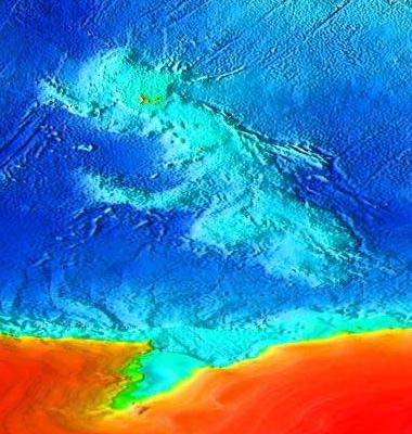
Topographical map of the submerged Kerguelen continent. |
|||
|---|---|---|---|---|
| Source |
Source: [1]. Cropped from Image:Elevation.jpg. |
|||
| Date |
14:45, 10 May 2007 (UTC) |
|||
| Author | ||||
| Permission (Reusing this image) |
|
File history
Click on a date/time to view the file as it appeared at that time.
| Date/Time | Dimensions | User | Comment | |
|---|---|---|---|---|
| current | 15:03, 10 May 2007 | 380×400 (37 KB) | Wiz9999 | |
| 14:45, 10 May 2007 | 4,320×2,160 (1.86 MB) | Wiz9999 | ({{Information |Description=Topographical map of the submerged Kerguelen continent. |Source=Source: [http://www.ngdc.noaa.gov/mgg/image/2minrelief.html]. Cropped from Image:Elevation.jpg. |Date=~~~~~ |Author=~~~ |Permission={{) |
File links
The following pages on the English Wikipedia link to this file (pages on other projects are not listed):

