Image:Kentucky Bend map.png
From Wikipedia, the free encyclopedia
Size of this preview: 600 × 600 pixels
Full resolution (720 × 720 pixels, file size: 31 KB, MIME type: image/png)
| | This is a file from the Wikimedia Commons. The description on its description page there is shown below.
|
| Description | |
|---|---|
| Source |
self; based on US Census TIGER generated map image |
| Date | |
| Author |
Jim Efaw (self) |
| Permission (Reusing this image) |
CC-By-SA for overlay; original map is public domain US government work |
| Other versions | Image:Kentucky Bend.png |
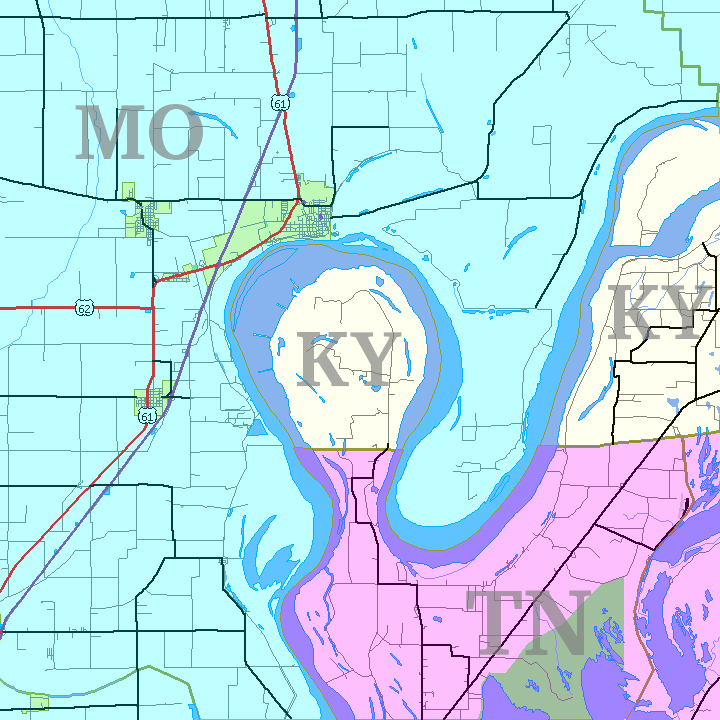
English: This is a map of the Kentucky Bend, the southwest corner of Fulton County, Kentucky that was separated from the rest of the state by the change in the Mississippi River from the New Madrid earthquakes. Based on United States Census TIGER Map output. Color and state abbreviation overlays created using The Gimp; optimized using pngnq and PNGOUT. 720×720, 32 color 8-bit palette.
[edit] License
|
File history
Click on a date/time to view the file as it appeared at that time.
| Date/Time | Dimensions | User | Comment | |
|---|---|---|---|---|
| current | 05:35, 14 January 2007 | 720×720 (31 KB) | Closeapple | ({{Information |Description=Map of Kentucky Bend w:exclave between Missouri and Tennessee, USA. |Source=self; based on [http://tiger.census.gov/cgi-bin/mapper/map.gif?&lat=39.74099&lon=-89.07248&ht=6.000&wid=5.000&on=CITIES&on=shorelin&on=states&on) |
File links
The following pages on the English Wikipedia link to this file (pages on other projects are not listed):

