Image:KCMH Airport Map.png
From Wikipedia, the free encyclopedia
Size of this preview: 419 × 599 pixels
Full resolution (537 × 768 pixels, file size: 73 KB, MIME type: image/png)
| | This is a file from the Wikimedia Commons. The description on its description page there is shown below.
|
| Description |
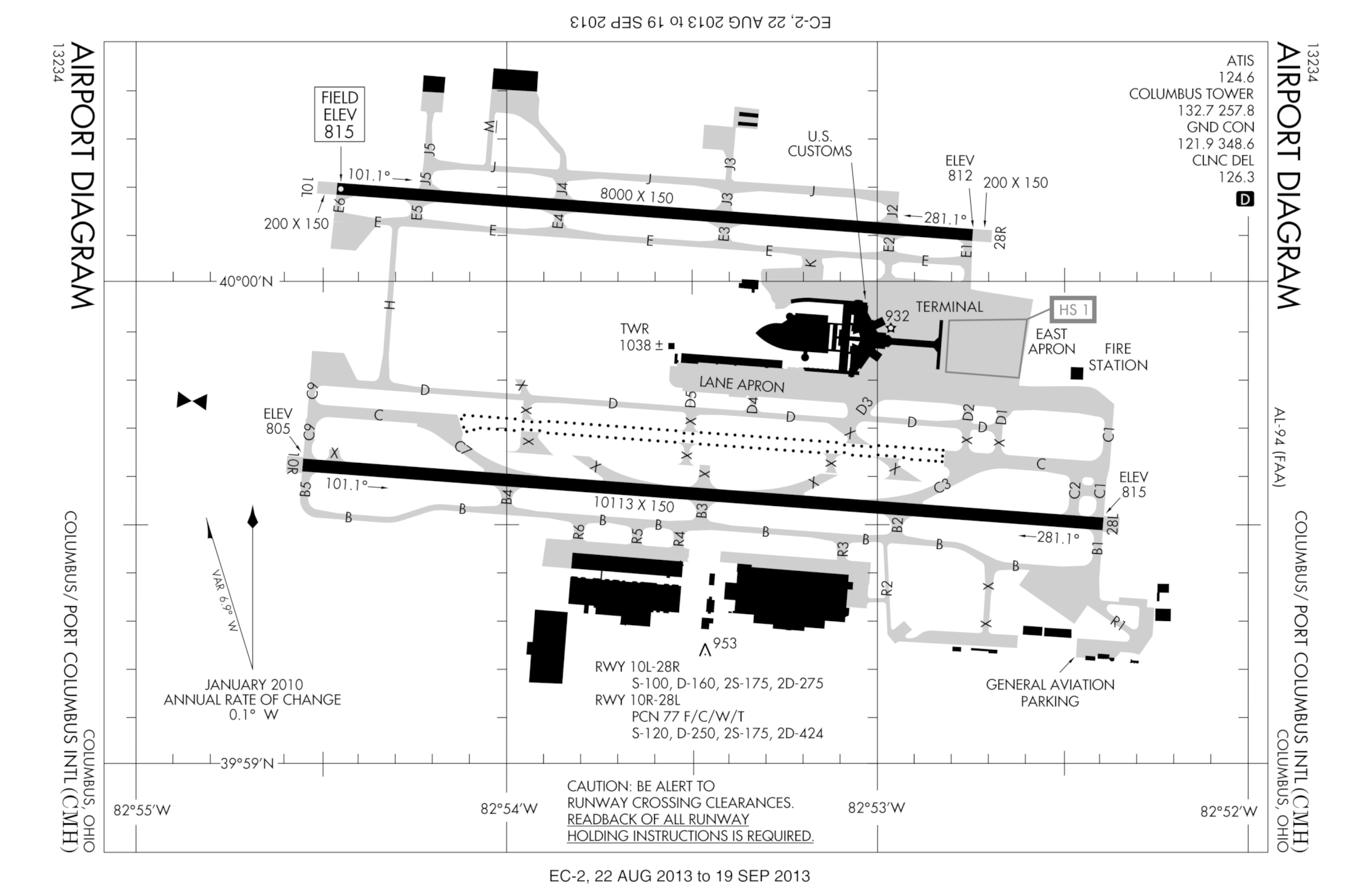
English: FAA diagram for en:Port Columbus International Airport (CMH) in Columbus, Ohio, United States.
en:commons:category:Port Columbus International Airport en:commons:category:Federal Aviation Administration en:commons:category:Maps en:Category:Airports in the United States en:Category:Airport map |
|---|---|
| Source |
Transferred from en.wikipedia; Transfer was stated to be made by User:Nobunaga24. |
| Date |
2007-08-17 (original upload date) |
| Author |
Original uploader was Polypmaster at en.wikipedia |
| Permission (Reusing this image) |
PD-USGOV-FAA. |
[edit] License information
| This image is a work of a Federal Aviation Administration employee, taken or made during the course of an employee's official duties. As works of the U.S. federal government, all FAA images are in the public domain. |  |
[edit] Original upload log
The original description page is/was here. All following user names refer to en.wikipedia.
- 2007-08-17 02:27 Polypmaster 537×768×8 (74297 bytes) {{Information | Description = FAA diagram for [[Port Columbus International Airport]] (CMH) in Columbus, Ohio, United States. | Source = http://naco.faa.gov/d-tpp/0709/00094AD.PDF<br/>Note: this URL changes monthly, for current diagram see:
File history
Click on a date/time to view the file as it appeared at that time.
| Date/Time | Dimensions | User | Comment | |
|---|---|---|---|---|
| current | 05:42, 1 May 2008 | 537×768 (73 KB) | File Upload Bot (Magnus Manske) | ( {{BotMoveToCommons|en.wikipedia}} {{Information |Description={{en|FAA diagram for en:Port Columbus International Airport (CMH) in Columbus, Ohio, United States.<br/> en:commons:category:Port Columbus International Airport [[:en:commons:categor) |

