Image:Kazakhstan provinces numbered english.png
From Wikipedia, the free encyclopedia
No higher resolution available.
Kazakhstan_provinces_numbered_english.png (500 × 285 pixels, file size: 14 KB, MIME type: image/png)
| | This is a file from the Wikimedia Commons. The description on its description page there is shown below.
|
[edit] Summary
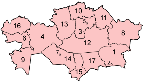
Map of the provinces of Kazakhstan in alphabetical order in English.
Made by User:Golbez based on a PD United Nations map; its borders are different from the available CIA maps, but the UN map is several years newer.
[edit] Licensing
|

File history
Click on a date/time to view the file as it appeared at that time.
| Date/Time | Dimensions | User | Comment | |
|---|---|---|---|---|
| current | 05:32, 6 January 2006 | 500×285 (14 KB) | Golbez | (Map of the provinces of Kazakhstan in alphabetical order in English. Made by User:Golbez based on a PD United Nations map; its borders are different from the available CIA maps, but the UN map is several years newer. Category:Maps of Kazakhstan) |
File links
The following pages on the English Wikipedia link to this file (pages on other projects are not listed):

