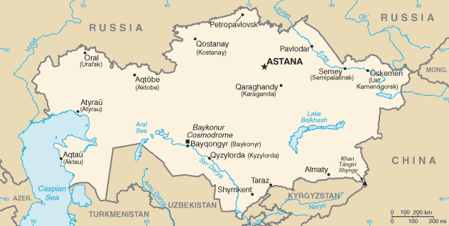
Image:Kazakhstan-CIA WFB Map.png
From Wikipedia, the free encyclopedia
No higher resolution available.
Kazakhstan-CIA_WFB_Map.png (634 × 324 pixels, file size: 21 KB, MIME type: image/png)
| | This is a file from the Wikimedia Commons. The description on its description page there is shown below.
|
| This image is in the public domain because it contains materials that originally came from the United States Central Intelligence Agency's World Factbook.
Deutsch | English | Español | Français | 日本語 | Nederlands | 한국어 | Português | தமிழ் | Magyar | +/- |
 |
 |
This map image should be recreated using vector graphics as an SVG file. This has several advantages; see Commons:Media for cleanup for more information. If an SVG form of this image is already available, please upload it. After uploading an SVG, replace this template with template {{Vector version available|new image name.svg}} in this image. |
|
العربية | Български | Català | Česky | Dansk | Deutsch | English | Esperanto | Español | Français | 한국어 | Italiano | Magyar | Lietuvių | Nederlands | 日本語 | Polski | Português | Română | Русский | Suomi | Svenska | Türkçe | Українська | Tiếng Việt | मराठी | 中文(繁體) | 中文(简体) | +/- |
|
File history
Click on a date/time to view the file as it appeared at that time.
| Date/Time | Dimensions | User | Comment | |
|---|---|---|---|---|
| current | 22:48, 16 August 2006 | 634×324 (21 KB) | Aivazovsky | (Fixing map to match present version on the CIA World Factbook site. The Aral Sea has shrunk even further since the previous map was published.) |
| 09:15, 27 March 2005 | 659×338 (25 KB) | Wolfman | ({{CIA-map}}) |
File links
The following pages on the English Wikipedia link to this file (pages on other projects are not listed):

