Image:Karte Oscarsborg.png
From Wikipedia, the free encyclopedia
Size of this preview: 471 × 600 pixels
Full resolution (570 × 726 pixels, file size: 173 KB, MIME type: image/png)
| | This is a file from the Wikimedia Commons. The description on its description page there is shown below.
|
[edit] Summary
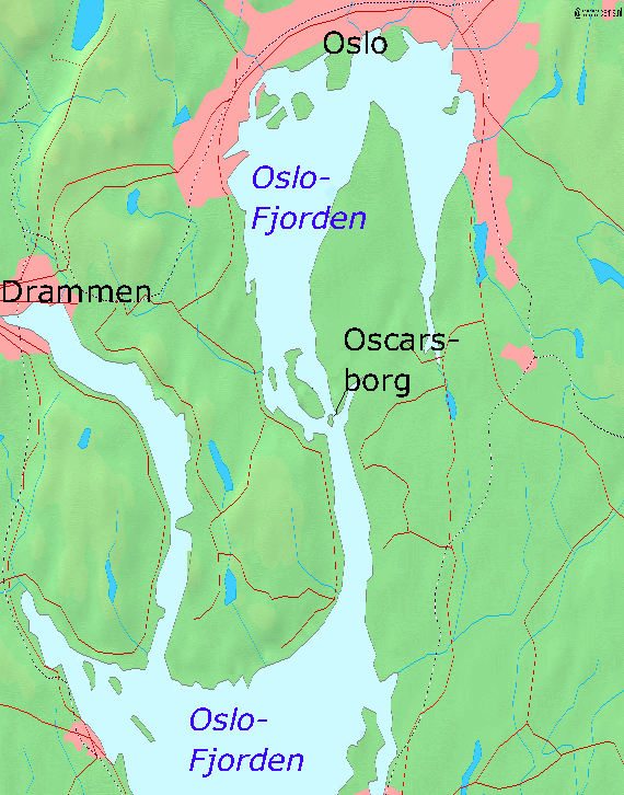
- Map of the Oslofjord and the fortress of Oscarsborg
- Source of Map: [1]
[edit] Licensing

File history
Click on a date/time to view the file as it appeared at that time.
| Date/Time | Dimensions | User | Comment | |
|---|---|---|---|---|
| current | 19:23, 7 April 2005 | 570×726 (173 KB) | Markus Schweiss | (Map refined with help of a norwegian wikipedian and his nautical chart of this area, sent by E-Mail to me {{GFDL}}) |
| 04:32, 4 April 2005 | 570×726 (173 KB) | Markus Schweiss | (Map correction {{GFDL}}) | |
| 20:48, 3 April 2005 | 570×726 (173 KB) | Markus Schweiss | (Correction of the map, {{GFDL}}) | |
| 20:24, 3 April 2005 | 570×726 (173 KB) | Markus Schweiss | (Map of the Oslofjord and the fortress of Oscarsborg, Source of Map: [http://www2.demis.nl/mapserver/mapper.asp] {{GFDL}} Category:Norwegian history) |
File links
The following pages on the English Wikipedia link to this file (pages on other projects are not listed):

