Image:Karta sydamerika 1892.jpg
From Wikipedia, the free encyclopedia
Size of this preview: 436 × 599 pixels
Full resolution (1,222 × 1,678 pixels, file size: 417 KB, MIME type: image/jpeg)
| | This is a file from the Wikimedia Commons. The description on its description page there is shown below.
|
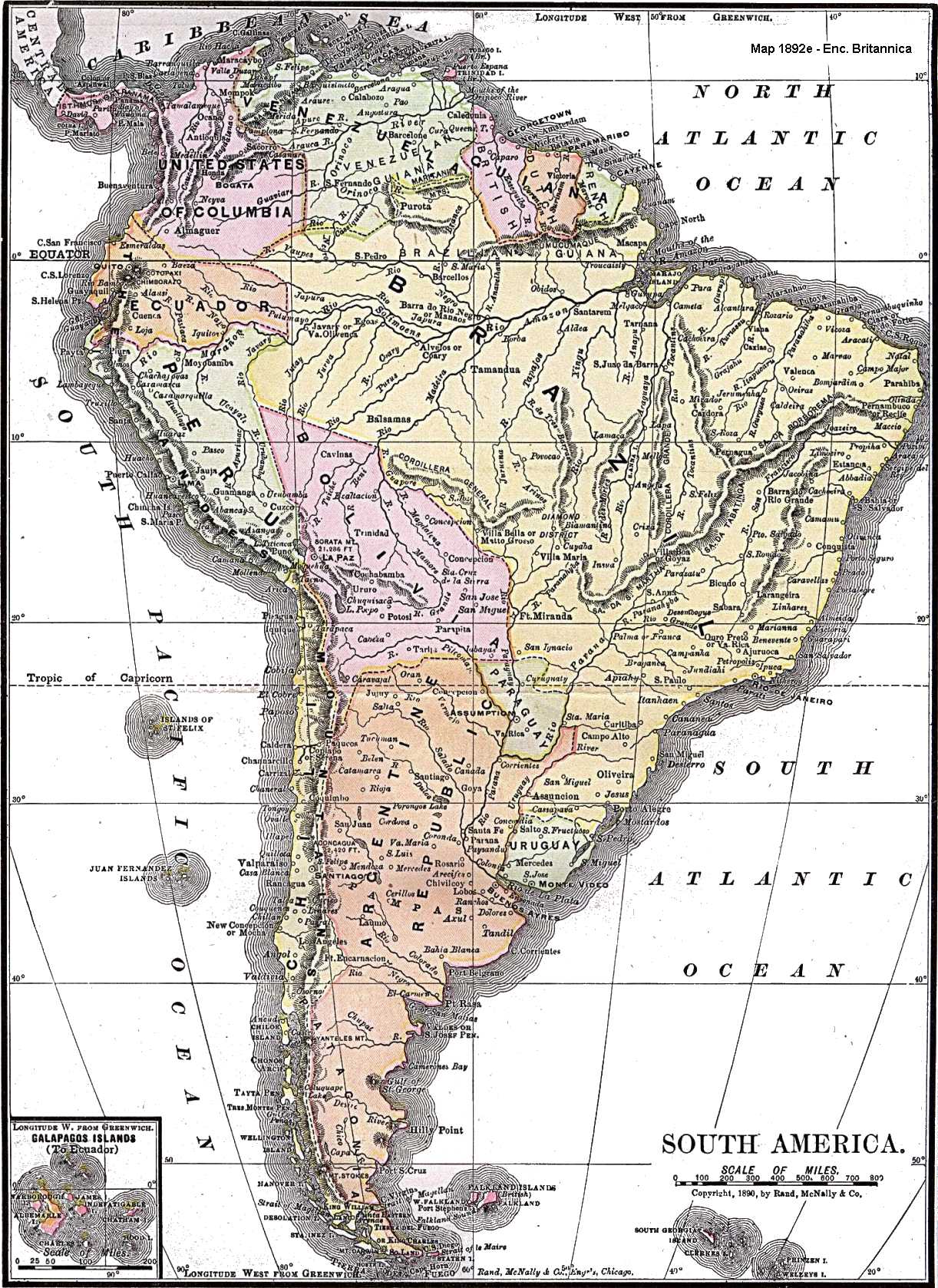
Map of South America from 1892.
Source: www.brazilbrazil.com
This photographic reproduction is therefore also in the public domain. العربية | Česky | Deutsch | English | Ελληνικά | Español | فارسی | Français | עברית | Bahasa Indonesia | Italiano | 日本語 | 한국어 | Magyar | Nederlands | Polski | Português | Română | Русский | Slovenščina | Српски / Srpski | Basa Sunda | Türkçe | Українська | 中文(繁體) | 中文(简体) | +/- |
File history
Click on a date/time to view the file as it appeared at that time.
| Date/Time | Dimensions | User | Comment | |
|---|---|---|---|---|
| current | 22:29, 24 January 2005 | 1,222×1,678 (417 KB) | Thuresson | (Map of South America from 1892. Source: [http://www.brazilbrazil.com/allmap.html www.brazilbrazil.com] {{PD}}) |

