Image:Karnataka districts-new.svg
From Wikipedia, the free encyclopedia

Karnataka_districts-new.svg (SVG file, nominally 2000 × 2356 pixels, file size: 215 KB)
[edit] Summary
Modified version of Karnataka_districts.svg, which is under GFDL.
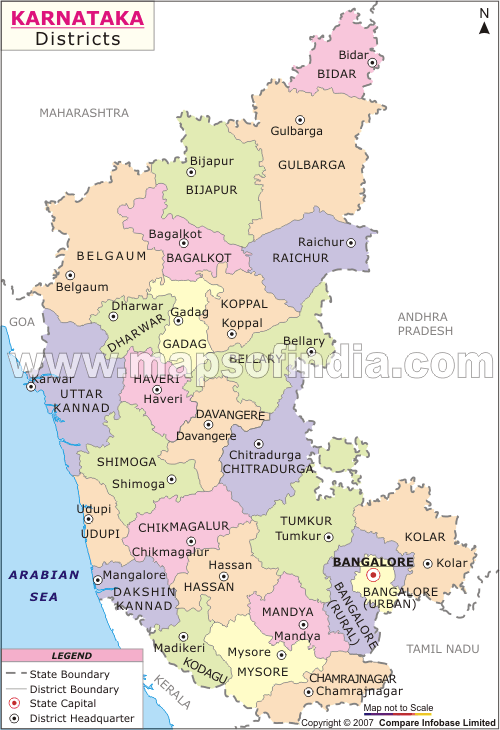
There is an ambiguity in the map of Karnataka mentioned above. There are two districts numbered 18. The one in green (18) is Coorg or Kodagu and the one in Baige(18) is Kolar. Reference link is
http://www.mapsofindia.com/maps/karnataka/karnataka-district-map.gif
[edit] Licensing
 |
Permission is granted to copy, distribute and/or modify this document under the terms of the GNU Free Documentation License, Version 1.2 or any later version published by the Free Software Foundation; with no Invariant Sections, no Front-Cover Texts, and no Back-Cover Texts. |
File history
Click on a date/time to view the file as it appeared at that time.
| Date/Time | Dimensions | User | Comment | |
|---|---|---|---|---|
| current | 12:22, 17 October 2007 | 2,000×2,356 (215 KB) | Naveenbm (Talk | contribs) | |
| 01:55, 17 July 2007 | 2,000×2,356 (215 KB) | Naveenbm (Talk | contribs) | (Modified verson of Karnataka_districts.svg, which is under GFDL.) |
- Search for duplicate files
- Edit this file using an external application
See the setup instructions for more information.
File links
The following pages on the English Wikipedia link to this file (pages on other projects are not listed):

