Image:Juba map2.jpg
From Wikipedia, the free encyclopedia
No higher resolution available.
Juba_map2.jpg (598 × 457 pixels, file size: 88 KB, MIME type: image/jpeg)
| | This is a file from the Wikimedia Commons. The description on its description page there is shown below.
|
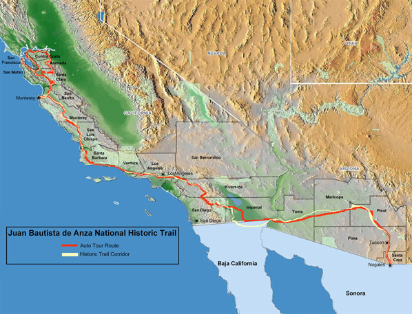
{{Information |Description=Juan Bautista de Anza National Historic Trail |Source=http://www.nps.gov/juba/planyourvisit/directions.htm |Date=11/22/06 |Author=unknown |Permission=
| This image or media file contains material based on a work of a National Park Service employee, created during the course of the person's official duties. As a work of the U.S. federal government, such work is in the public domain. See the NPS website and NPS copyright policy for more information. |
 |
File history
Click on a date/time to view the file as it appeared at that time.
| Date/Time | Dimensions | User | Comment | |
|---|---|---|---|---|
| current | 05:20, 22 November 2006 | 598×457 (88 KB) | Evrik | ({{Information |Description=Juan Bautista de Anza National Historic Trail |Source=http://www.nps.gov/juba/planyourvisit/directions.htm |Date=11/22/06 |Author=unknown |Permission={{PD-USGov-NPS |other_versions=http://www.solideas.com/DeAnza/TrailGuide/ }} ) |
File links
The following pages on the English Wikipedia link to this file (pages on other projects are not listed):

