Image:Italy c 1810.png
From Wikipedia, the free encyclopedia
Size of this preview: 413 × 599 pixels
Full resolution (1,251 × 1,814 pixels, file size: 385 KB, MIME type: image/png)
| | This is a file from the Wikimedia Commons. The description on its description page there is shown below.
|
[edit] Summary
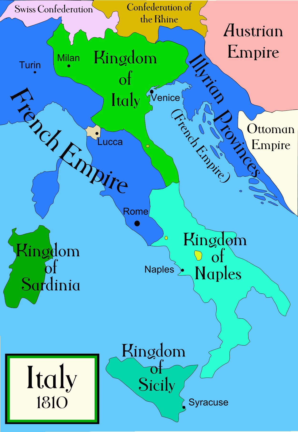
Political map of Italy in the years around 1810, during the Napoleonic era, created by MapMaster. This is a companion map to Image:Italy 1796.png and Image:Italy 1494.png. An SVG version of this map (with Slovenian labels) can be found at Image:Italija_1810_Slovenscina.svg.
[edit] References
- Bjorklund, Oddvar; Holmboe, Haakon; Rohr, Anders (1970) Historical Atlas of the World, Barnes & Noble, NY, SBN: 389-00253-4.
- Other maps, including Image:1french-empire1811.jpg from the 1912 Cambridge Modern History Atlas.
[edit] Licensing

File history
Click on a date/time to view the file as it appeared at that time.
| Date/Time | Dimensions | User | Comment | |
|---|---|---|---|---|
| current | 04:01, 19 October 2006 | 1,251×1,814 (385 KB) | MapMaster | (Further improvements to bring it into line with Image:Italy 1796.png) |
| 12:41, 13 October 2006 | 1,251×1,814 (403 KB) | MapMaster | (Map was slightly improved.) | |
| 12:00, 13 October 2006 | 1,265×1,816 (402 KB) | MapMaster | (Political map of Italy in the years around 1810, during the Napoleonic era, created by MapMaster.) |
File links
The following pages on the English Wikipedia link to this file (pages on other projects are not listed):

