Image:Italy Regions 220px (including Pelagie Islands).png
From Wikipedia, the free encyclopedia
No higher resolution available.
Italy_Regions_220px_(including_Pelagie_Islands).png (211 × 283 pixels, file size: 6 KB, MIME type: image/png)
| | This is a file from the Wikimedia Commons. The description on its description page there is shown below.
|
 It is recommended that the other file be used. Alemannisch | العربية | Български | Česky | Dansk | Deutsch | English | Ελληνικά | Esperanto | Español | Français | Galego | עברית | हिन्दी | Magyar | Bahasa Indonesia | Italiano | 日本語 | 한국어 | Lietuvių | Nederlands | Norsk (nynorsk) | Polski | Português | Română | Русский | Slovenščina | Српски / Srpski | Svenska | Türkçe | 中文(简体) | 中文(繁體) | +/- |
| Description |
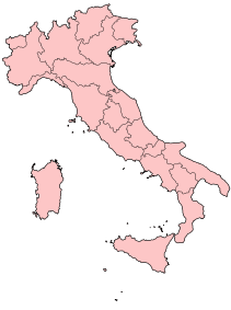
Geographic map of the Republic of Italy, including the Pelagie Islands (Lampedusa and Linosa). Derived from en:w:Image:Italy Regions 220px.png. |
|---|---|
| Source |
Originally from en.wikipedia; description page is/was here. |
| Date |
2006-07-16 (first version); 2006-07-16 (last version) |
| Author |
Original uploader was Angelo.romano at en.wikipedia |
| Permission (Reusing this image) |
Released under the GNU Free Documentation License. |
[edit] License information

[edit] Original upload log
(All user names refer to en.wikipedia)
- 2006-07-16 01:58 Angelo.romano 211×283×8 (15604 bytes) Geographic map of the Republic of Italy, including the Pelagie Islands (Lampedusa and Linosa). Derived from [[w:Image:Italy Regions 220px.png]]. {{GFDL}}
- 2006-07-16 01:51 Angelo.romano 211×283×8 (15563 bytes) Geographic map of the Republic of Italy, including the Pelagie Islands (Lampedusa and Linosa). Derived from [[w:Image:Italy Regions 220px.png]]. {{GFDL}}
- 2006-07-16 01:37 Angelo.romano 211×283×8 (15211 bytes) Geographic map of the Republic of Italy, including the Pelagie Islands (Lampedusa and Linosa). Derived from [[Image:Italy Regions 220px.png]]. {{GFDL}}
File history
Click on a date/time to view the file as it appeared at that time.
| Date/Time | Dimensions | User | Comment | |
|---|---|---|---|---|
| current | 16:11, 6 June 2008 | 211×283 (6 KB) | TomTheHand | (Uploading optimized version based on SVG) |
| 23:20, 3 March 2007 | 211×283 (15 KB) | Ppntori | ({{GFDL-user-en|Angelo.romano}}) |


.png)