Image:IrishSeaReliefMap.jpg
From Wikipedia, the free encyclopedia
No higher resolution available.
IrishSeaReliefMap.jpg (461 × 561 pixels, file size: 84 KB, MIME type: image/jpeg)
| | This is a file from the Wikimedia Commons. The description on its description page there is shown below.
|
| Description |
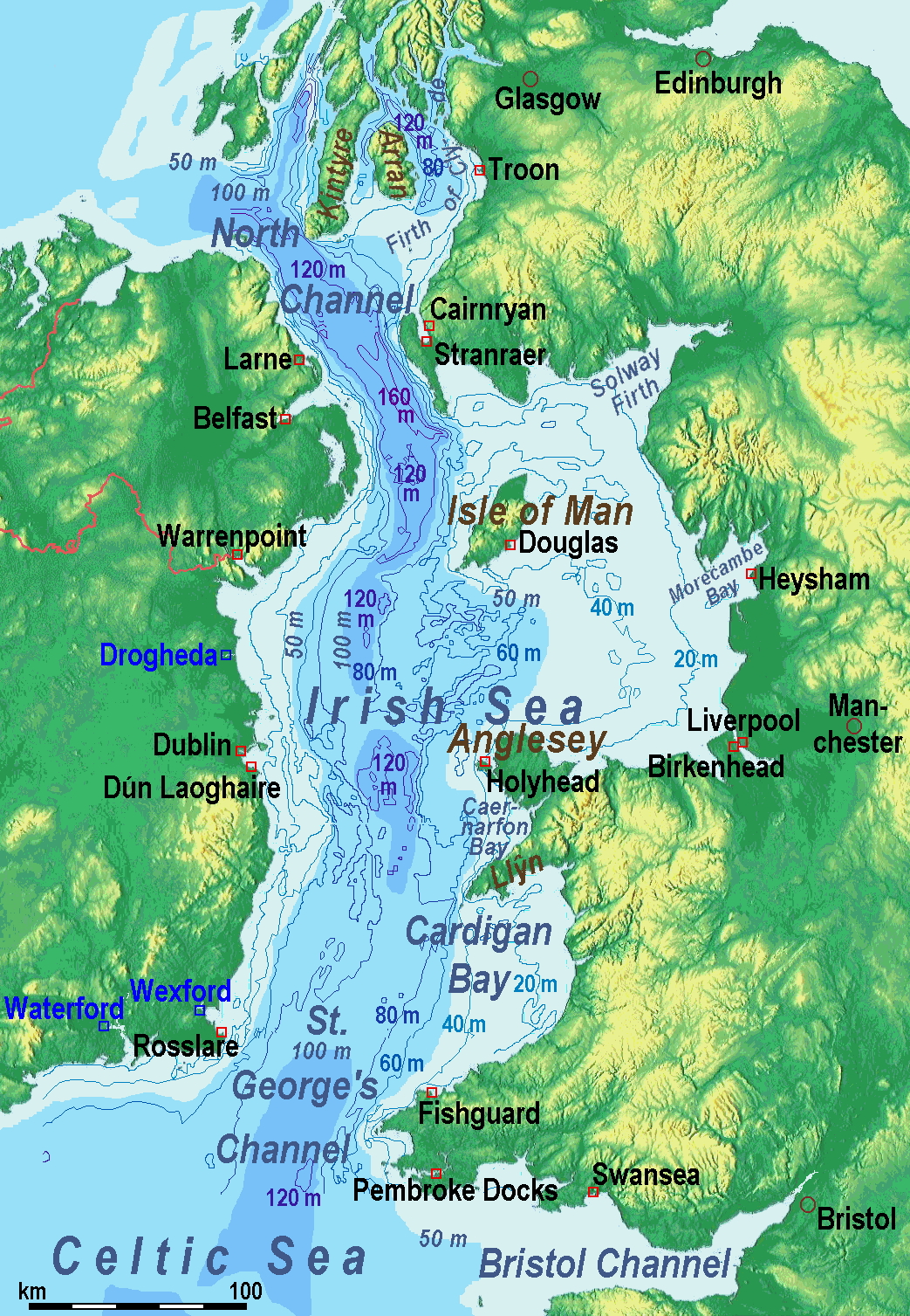
A map of the en:Irish Sea Major ports shown in red. freight only ports in blue. |
||
|---|---|---|---|
| Source | No source specified. Please edit this image description and provide a source. | ||
| Date | |||
| Author |
Users SFC9394, Seabhcan on en.wikipedia |
||
| Permission (Reusing this image) |
|
||
| Other versions |
Originally from en.wikipedia; description page is (was) here
|
(Uploaded using CommonsHelper or PushForCommons)
File history
Click on a date/time to view the file as it appeared at that time.
| Date/Time | Dimensions | User | Comment | |
|---|---|---|---|---|
| current | 09:01, 1 November 2006 | 461×561 (84 KB) | Korrigan | ({{Information| |Description= A map of the en:Irish Sea Major ports shown in red. freight only ports in blue. |Source= |Date= |Author=Users SFC9394, Seabhcan on [http://en.wikipedia.org en.wikipedia] |Permiss) |
File links
The following pages on the English Wikipedia link to this file (pages on other projects are not listed):

