Image:International Hydrographic Organization countries.PNG
From Wikipedia, the free encyclopedia
Size of this preview: 800 × 370 pixels
Full resolution (1,350 × 625 pixels, file size: 54 KB, MIME type: image/png)
| | This is a file from the Wikimedia Commons. The description on its description page there is shown below.
|
[edit] Summary
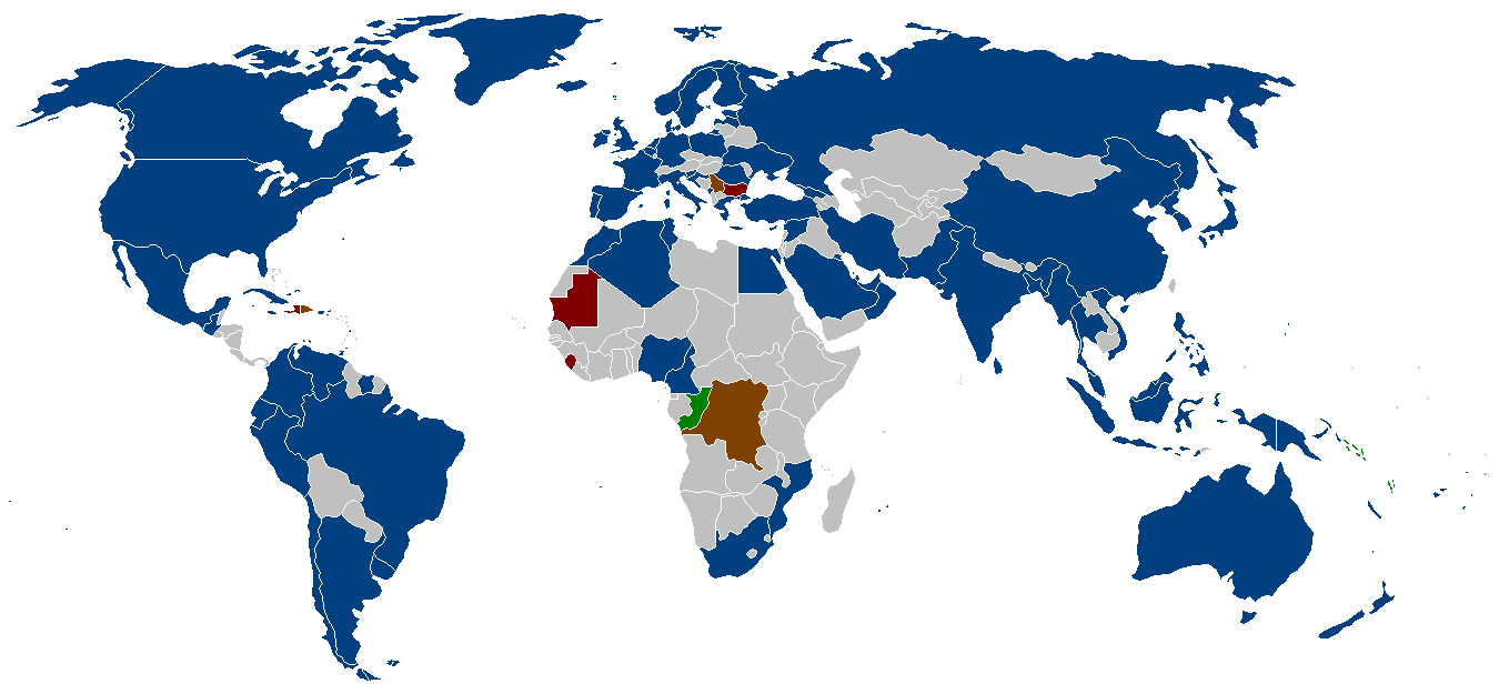
The member states of the International Hydrographic Organization as listed on their website.
- Blue = members
- Brown = suspended members
- Red = approved, but awaiting deposit of Instrument of Accession
- Green = membership Applications
[edit] Licensing

File history
Click on a date/time to view the file as it appeared at that time.
| Date/Time | Dimensions | User | Comment | |
|---|---|---|---|---|
| current | 03:17, 6 June 2006 | 1,350×625 (54 KB) | Zntrip | (Added Montenegro) |
| 02:44, 16 May 2006 | 1,350×625 (54 KB) | Zntrip | (added more stiff) | |
| 02:39, 16 May 2006 | 1,350×625 (54 KB) | Zntrip | (Updated) | |
| 12:25, 28 April 2006 | 1,357×628 (53 KB) | Roke | (forgot china) | |
| 12:23, 28 April 2006 | 1,357×628 (53 KB) | Roke | (member states of the w:International Hydrographic Organization as listed on their [http://www.iho.shom.fr/ website] *yellow= members *orange = suspended members (note there is a mistake in their map - which shows the republic of Congo, instead of t) |
File links
The following pages on the English Wikipedia link to this file (pages on other projects are not listed):

