Image:Imera-meridionale-map-bjs.jpg
From Wikipedia, the free encyclopedia
No higher resolution available.
Imera-meridionale-map-bjs.jpg (750 × 551 pixels, file size: 63 KB, MIME type: image/jpeg)
| | This is a file from the Wikimedia Commons. The description on its description page there is shown below.
|
[edit] Description
| Description |
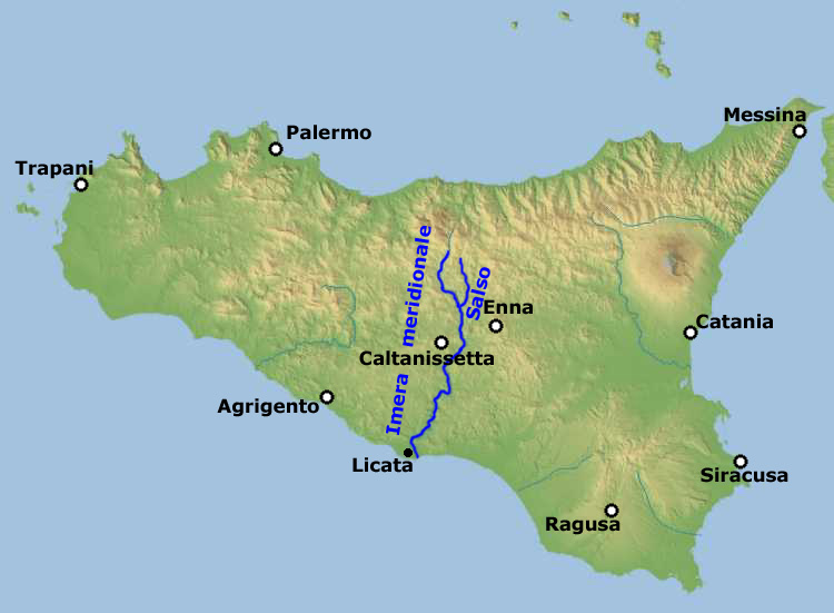
English: Physical map of Sicily, equirectangular cylindrical projection, including the course of river Imera meridionale (also called Salso) with its two source rivers Imera meridionale and Salso
Deutsch: Imera Meridionale / Salso.
Polski: Imera Meridionale/Salso.
Italiano: Imera Meridionale / Salso.
Latina: Huic imagini nondum est descriptio, quaeso descriptionem adde.
Sicilianu: L'Imera Miridiunali o Salsu.
|
|---|---|
| Source |
|
| Date |
December 2006 |
| Author |
Edited by Bernhard J. Scheuvens aka Bjs |
| Permission (Reusing this image) |
see below |
[edit] Licensing
| This file is licensed under the Creative Commons Attribution ShareAlike 2.5 License. In short: you are free to share and make derivative works of the file under the conditions that you appropriately attribute it, and that you distribute it only under a license identical to this one. Official license |
File history
Click on a date/time to view the file as it appeared at that time.
| Date/Time | Dimensions | User | Comment | |
|---|---|---|---|---|
| current | 16:17, 3 December 2006 | 750×551 (63 KB) | Bjs | |
| 15:40, 3 December 2006 | 750×551 (62 KB) | Bjs |
File links
The following pages on the English Wikipedia link to this file (pages on other projects are not listed):

