Image:Image-Interstate66-map.PNG
From Wikipedia, the free encyclopedia
No higher resolution available.
Image-Interstate66-map.PNG (800 × 229 pixels, file size: 27 KB, MIME type: image/png)
| | This is a file from the Wikimedia Commons. The description on its description page there is shown below.
|
| Description |
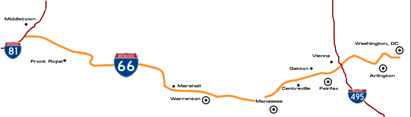
Map of Interstate 66 created by me, Ryanaxp, on August 11, 2006, using en:The GIMP on en:Debian ("Sarge") en:Linux, based on various sources of information (including an online map retrieved from en:Mapquest, as well as a map of Virginia roads published by en:ADC Map). All rights in this image are hereby dedicated to the public in their entirety by me, Ryanaxp, this August 11, 2006; and the image may therefore be freely copied, redistributed, altered, incorporated into derived works of any nature, and/or used for any purpose. |
|---|---|
| Source |
Originally from en.wikipedia; description page is/was here. |
| Date |
2006-08-11 (original upload date) |
| Author |
Original uploader was Ryanaxp at en.wikipedia |
| Permission (Reusing this image) |
Released into the public domain (by the author); PD-SELF. |
[edit] License information
| This image has been (or is hereby) released into the public domain by its author, Ryanaxp at the wikipedia project. This applies worldwide. In case this is not legally possible: |
| I, the copyright holder of this work, hereby release it into the public domain. This applies worldwide. In case this is not legally possible: Afrikaans | Alemannisch | Aragonés | العربية | Asturianu | Български | Català | Česky | Cymraeg | Dansk | Deutsch | Eʋegbe | Ελληνικά | English | Español | Esperanto | Euskara | Estremeñu | فارسی | Français | Galego | 한국어 | हिन्दी | Hrvatski | Ido | Bahasa Indonesia | Íslenska | Italiano | עברית | Kurdî / كوردی | Latina | Lietuvių | Latviešu | Magyar | Македонски | Bahasa Melayu | Nederlands | Norsk (bokmål) | Norsk (nynorsk) | 日本語 | Polski | Português | Ripoarisch | Română | Русский | Shqip | Slovenčina | Slovenščina | Српски / Srpski | Svenska | ไทย | Tagalog | Türkçe | Українська | Tiếng Việt | Walon | 中文(简体) | 中文(繁體) | zh-yue-hant | +/- |
[edit] Original upload log
(All user names refer to en.wikipedia)
- 2006-08-11 15:16 Ryanaxp 1000×286×8 (34596 bytes) Map of Interstate 66 created by me, [[User:Ryanaxp|Ryanaxp]], on August 11, 2006, using [[The GIMP]] on [[Debian]] ("Sarge") [[Linux]], based on various sources of information (including an online map retrieved from [[Mapquest]], as well as a map of Virgi
File history
Click on a date/time to view the file as it appeared at that time.
| Date/Time | Dimensions | User | Comment | |
|---|---|---|---|---|
| current | 19:43, 17 June 2007 | 800×229 (27 KB) | Squiggyfm | (Route of Interstate 66 with major locations served) |
| 22:16, 23 March 2007 | 1,000×286 (34 KB) | Krimpet | ({{Information |Description=Map of Interstate 66 created by me, Ryanaxp, on August 11, 2006, using en:The GIMP on en:Debian ("Sarge") en:Linux, based on various sources of information (including an online map retrieved f) |

