Image:Hutt River.png
From Wikipedia, the free encyclopedia
Size of this preview: 459 × 599 pixels
Full resolution (1,186 × 1,549 pixels, file size: 120 KB, MIME type: image/png)
| | This is a file from the Wikimedia Commons. The description on its description page there is shown below.
|
[edit] Summary
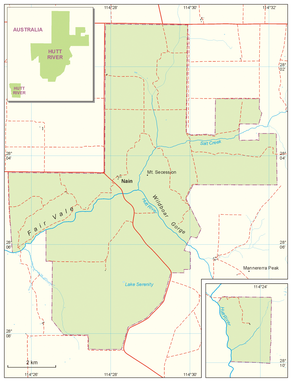
| Description |
Map of Principality of Hutt River |
|---|---|
| Source |
own work, based on: Australian topographic map 1:250.000, Satelitte images from Google Earth, maps from Hutt River web sites |
| Date |
13.04.2008 |
| Author | |
| Permission (Reusing this image) |
see below |
[edit] Licensing

File history
Click on a date/time to view the file as it appeared at that time.
| Date/Time | Dimensions | User | Comment | |
|---|---|---|---|---|
| current | 14:03, 13 April 2008 | 1,186×1,549 (120 KB) | Aotearoa | ({{Information |Description=Map of Principality of Hutt River |Source=own work, based on: Australian topographic map 1:250.000, Satelitte images from Google Earth, maps from Hutt River web sites |Date=13.04.2008 |Author= Aotearoa |Permiss) |
File links
The following pages on the English Wikipedia link to this file (pages on other projects are not listed):

