Image:Hazebrouck map.png
From Wikipedia, the free encyclopedia
No higher resolution available.
Hazebrouck_map.png (123 × 71 pixels, file size: 4 KB, MIME type: image/png)
| | This is a file from the Wikimedia Commons. The description on its description page there is shown below.
|
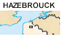
Hazebrouck, in the département of Nord, in France.

File history
Click on a date/time to view the file as it appeared at that time.
| Date/Time | Dimensions | User | Comment | |
|---|---|---|---|---|
| current | 09:32, 23 August 2005 | 123×71 (4 KB) | Jmsaus | (hazebrouck in the north of France ) |
File links
The following pages on the English Wikipedia link to this file (pages on other projects are not listed):

