Image:Hattusa.rampart.jpg
From Wikipedia, the free encyclopedia
Size of this preview: 403 × 599 pixels
Full resolution (588 × 874 pixels, file size: 178 KB, MIME type: image/jpeg)
| | This is a file from the Wikimedia Commons. The description on its description page there is shown below.
|
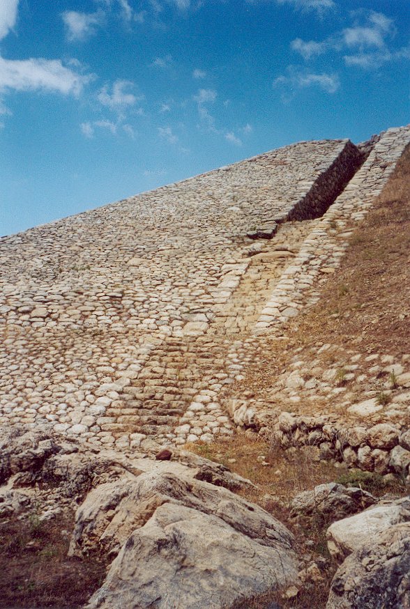
The Yerkapi rampart at Hattusa, Turkey. This artificial ridge marks the highest point in the city's fortifications. It is 250 meters long and at the foundation over 80 meters wide. Its name means 'gate in the earth'; indeed a tunnel - built whith corbeled arches -runs through the rampart.
Photo taken during our holidays in Turkey on July 7, 2001.
© 2001 User:China_Crisis
|
File history
Click on a date/time to view the file as it appeared at that time.
| Date/Time | Dimensions | User | Comment | |
|---|---|---|---|---|
| current | 16:06, 12 March 2005 | 588×874 (178 KB) | China Crisis | (The Yerkapi rampart at Hattusa, Turkey) |
File links
The following pages on the English Wikipedia link to this file (pages on other projects are not listed):

