Image:Gulf Intracoastal Waterway Galveston Bay.jpg
From Wikipedia, the free encyclopedia
Size of this preview: 800 × 534 pixels
Full resolution (1,500 × 1,001 pixels, file size: 838 KB, MIME type: image/jpeg)
| | This is a file from the Wikimedia Commons. The description on its description page there is shown below.
|
| Description |
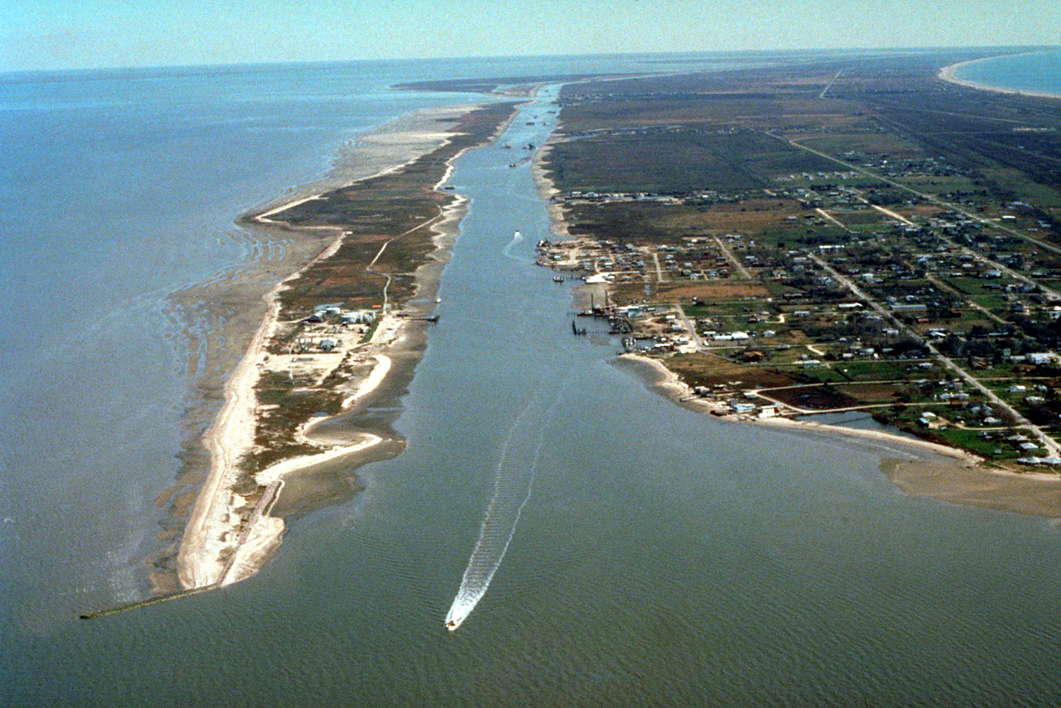
English: The Gulf Intracoastal Waterway enters Galveston Bay from the southwest end of the Bolivar Peninsula at the town of Port Bolivar, Galveston County, Texas, USA. The community of Port Bolivar lies at right at the end of the peninsula. Galveston Bay is the great body of water at left. A small piece of the Gulf of Mexico can be seen at upper right. The U.S. Army Corps of Engineers maintains and dredges the waterway for commercial barge navigation.
Coordinates: 29°22′28.91″N, 94°46′49.53″W |
|||
|---|---|---|---|---|
| Source |
U.S. Army Corps of Engineers Digital Visual Library |
|||
| Date |
1999-03-22 (Caveat: Dates provided by U.S. Army Corps of Engineers Digital Visual Library are not reliable and may be wrong.) |
|||
| Author |
U.S. Army Corps of Engineers, photographer not specified or unknown |
|||
| Permission (Reusing this image) |
|
File history
Click on a date/time to view the file as it appeared at that time.
| Date/Time | Dimensions | User | Comment | |
|---|---|---|---|---|
| current | 03:39, 10 May 2007 | 1,500×1,001 (838 KB) | DanMS | ({{Information | Description = {{en|The Gulf Intracoastal Waterway enters Galveston Bay from the southwest end of the Bolivar Peninsula at the town of Port Bolivar, Galveston County, Texas, USA. The community of Port Bolivar lies at right at the end of ) |
File links
The following pages on the English Wikipedia link to this file (pages on other projects are not listed):

