Image:Guadiana Mouth.jpg
From Wikipedia, the free encyclopedia
Size of this preview: 800 × 600 pixels
Full resolution (1,600 × 1,200 pixels, file size: 303 KB, MIME type: image/jpeg)
| | This is a file from the Wikimedia Commons. The description on its description page there is shown below.
|
[edit] Summary
| Description |
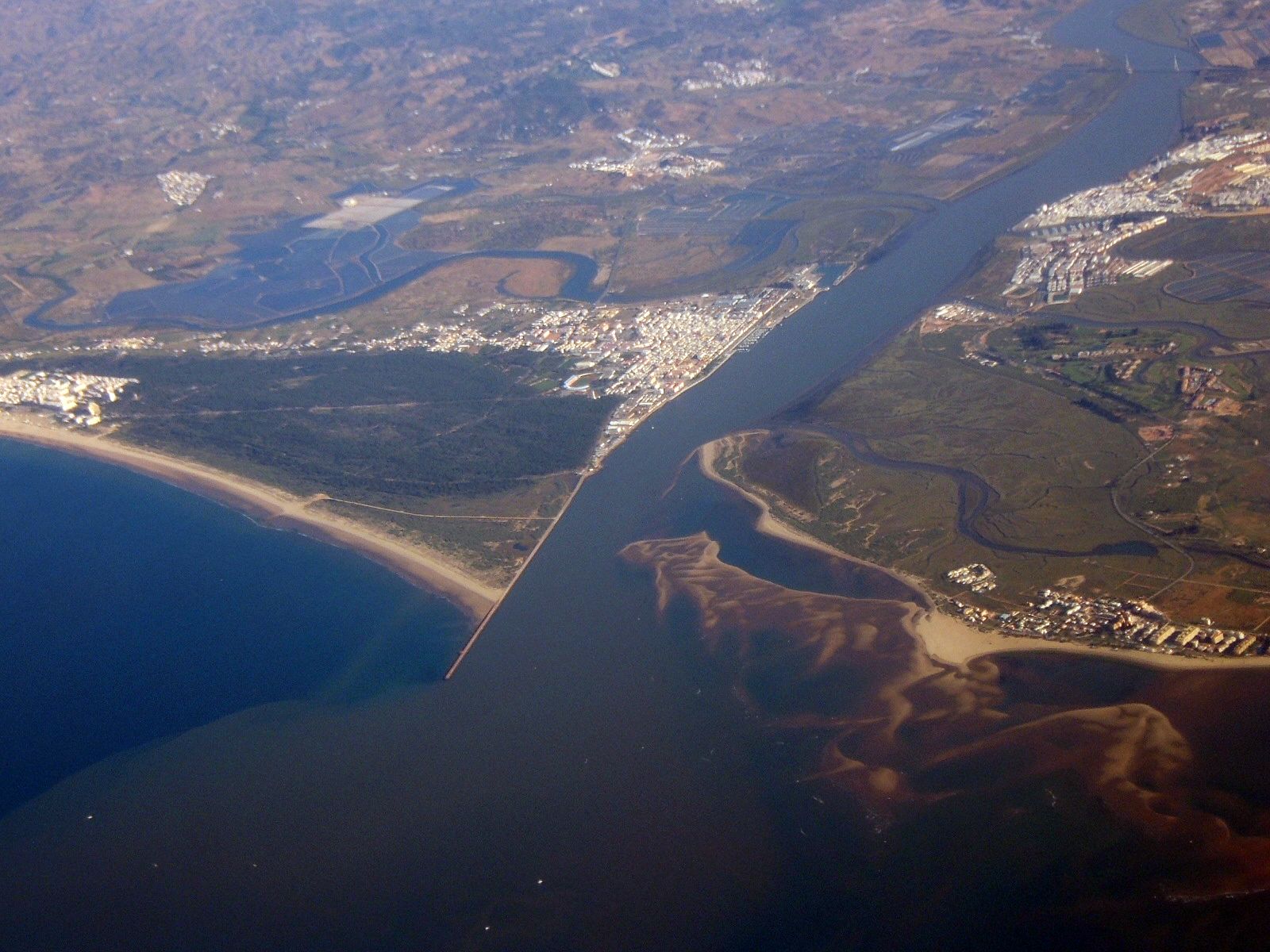
Aerial view of the mouth of the Guadiana (Español), Guadiana (Português), Guadiana (English) river flowing into the Atlantic Ocean. Portugal is on the left side of the image; Spain on the right side. The Portuguese town in the center of the image is Vila Real de Santo António, the Spanish town further north is Ayamonte. The small Spanish village at the sea is Isla Canela, the Portuguese coastal village on the very left is Monte Gordo. The village north of Monte Gordo is Três Azeitonas and the village north of Vila Real is Castro Marim, further north, Monte Francisco can be seen. At extreme top right, the Puente Internacional cable-stayed bridge can be seen. |
|---|---|
| Source |
self-made |
| Date |
2007 |
| Author | |
| Permission (Reusing this image) |
see below |
[edit] Licensing

File history
Click on a date/time to view the file as it appeared at that time.
| Date/Time | Dimensions | User | Comment | |
|---|---|---|---|---|
| current | 09:20, 15 June 2007 | 1,600×1,200 (303 KB) | Toksave | ({{Information |Description= Mouth of the Guadiana River in the Mediterranean Sea, Portugal is on the left side, Spain on the right side of the river. The portuguese town in the center of the image is Vila Real de Santo António, the spanish town further n) |
File links
Metadata
This file contains additional information, probably added from the digital camera or scanner used to create or digitize it. If the file has been modified from its original state, some details may not fully reflect the modified file.
| Camera manufacturer | FUJIFILM |
|---|---|
| Camera model | FinePix E500 |
| Exposure time | 1/170 sec (0.0058823529411765) |
| F-number | f/5 |
| Date and time of data generation | 09:09, 16 May 2007 |
| Lens focal length | 13.3 mm |
| Orientation | Normal |
| Horizontal resolution | 72 dpi |
| Vertical resolution | 72 dpi |
| Software used | Digital Camera FinePix E500 Ver1.00 |
| File change date and time | 09:09, 16 May 2007 |
| Y and C positioning | 2 |
| Exposure Program | Normal program |
| ISO speed rating | 100 |
| Exif version | 2.2 |
| Date and time of digitizing | 09:09, 16 May 2007 |
| Image compression mode | 2.6 |
| Shutter speed | 7.4 |
| Aperture | 4.6 |
| Brightness | 6.17 |
| Exposure bias | 0 |
| Maximum land aperture | 3.1 |
| Metering mode | Pattern |
| Light source | Unknown |
| Flash | 16 |
| Color space | sRGB |
| Focal plane X resolution | 2777 |
| Focal plane Y resolution | 2777 |
| Focal plane resolution unit | 3 |
| Sensing method | One-chip color area sensor |
| Custom image processing | Normal process |
| Exposure mode | Auto exposure |
| White balance | Auto white balance |
| Scene capture type | Standard |
| Sharpness | 3 |
| Subject distance range | Unknown |

