Image:Grossraum Basel.png
From Wikipedia, the free encyclopedia
Size of this preview: 800 × 573 pixels
Full resolution (1,500 × 1,075 pixels, file size: 1.29 MB, MIME type: image/png)
| | This is a file from the Wikimedia Commons. The description on its description page there is shown below.
|
| Description |
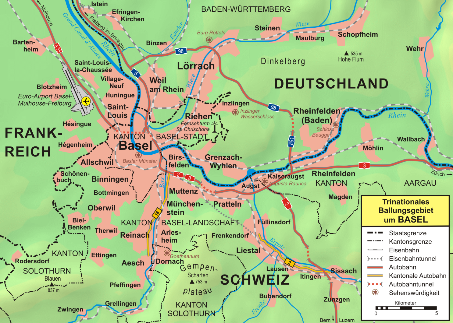
Topographische Karte vom Großraum Basel |
|---|---|
| Source |
own work, used:
|
| Date |
October 2007 |
| Author |
first version by Wladyslaw Sojka, complete reworked version by Lencer |
| Permission (Reusing this image) |
see below |
| Other versions | SVG-Version |

Deutsch: Diese Karte wurde in der Kartenwerkstatt erstellt oder verbessert. Auch du kannst uns verbesserungswürdige Karten vorschlagen.
English: This map has been made or improved in the German Kartenwerkstatt (Map Lab). You can propose maps to improve as well.
Français : Cette carte a été créée ou améliorée dans le Kartenwerkstatt (Atelier cartographique) allemand. Vous pouvez également y proposer des cartes à améliorer.
Italiano: Questa carta è stata prodotta e/o migliorata nella tedesca Kartenwerkstatt (Officine per le carte). Anche Tu puoi proporre carte degne di miglioramento.
Русский: Эта карта была улучшена в немецкой Kartenwerkstatt. Вы можете также предложить другие карты для улучшения.
| This file is licensed under the Creative Commons Attribution ShareAlike 3.0 Unported License. In short: you are free to share and make derivative works of the file under the conditions that you appropriately attribute it, and that you distribute it only under a license compatible with this one.
العربية | Català | Česky | Deutsch | Ελληνικά | English | Esperanto | Español | Français | Italiano | עברית | 日本語 | 한국어 | Magyar | Nederlands | Plattdüütsch | Polski | Português | Русский | Svenska | Tiếng Việt | Українська | +/- |
File history
Click on a date/time to view the file as it appeared at that time.
| Date/Time | Dimensions | User | Comment | |
|---|---|---|---|---|
| current | 19:40, 19 October 2007 | 1,500×1,075 (1.29 MB) | Lencer | |
| 16:16, 18 October 2007 | 1,500×1,075 (1.41 MB) | Lencer | ||
| 15:38, 18 October 2007 | 1,500×1,074 (1.41 MB) | Lencer | ({{Information| |Description=Topographische Karte vom Großraum Basel |Source=own work, used: * [http://www.maps-for-free.com/ Google Maps-For-Free] SRTM3 Webserver * [http://www.openstreetmap.org/index.html OpenStreetMap] Webserver * [http:) | |
| 16:59, 24 December 2006 | 2,068×1,422 (1.99 MB) | W-j-s | ({{Information |Description=''no original description'' |Source=Originally from [http://de.wikipedia.org de.wikipedia]; description page is/was [http://de.wikipedia.org/w/index.php?title=Image%3AGrossraum_Basel.png here]. |Date=2006-09-04 (first version); ) |
File links
The following pages on the English Wikipedia link to this file (pages on other projects are not listed):

