Image:GoughMap ca 1360.jpg
From Wikipedia, the free encyclopedia
Size of this preview: 800 × 423 pixels
Full resolution (1,096 × 580 pixels, file size: 168 KB, MIME type: image/jpeg)
| | This is a file from the Wikimedia Commons. The description on its description page there is shown below.
|
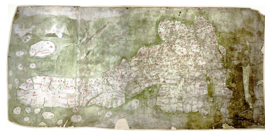
The Gough Map is the oldest extant map of the roads of medieval Britain. It is about 115 x 56cm large and was made around 1360. It is named after Richard Gough, who donated the map to the Bodleian Library in 1809.
East is on the top.
[edit] Summary
| Description |
The Gough Map or Bodleian Map is a road map of Great Britain, dating from around 1360. |
|---|---|
| Source |
anonymous, Scan by the Bodleian Library |
| Date | |
| Author | |
| Permission (Reusing this image) |
PD-old |
[edit] Links
- The Gough Map Bodleian Library information page
- Britain's first road map Oxford University Magazine 18,2 (2006)
- Interactive Map, joint effort of Queen's University Belfast and Bodleian Library
[edit] Licensing
| This image (or other media file) is in the public domain because its copyright has expired. This applies to the United States, Canada, the European Union and those countries with a copyright term of life of the author plus 70 years.
العربية | Asturianu | Български | Català | Česky | Dansk | Deutsch | English | Ελληνικά | Esperanto | Español | Euskara | فارسی | Français | Gaeilge | Galego | עברית | हिन्दी | Bahasa Indonesia | Italiano | 日本語 | 한국어 | Kurdî / كوردی | Lietuvių | Magyar | Nederlands | Norsk (nynorsk) | Bahasa Melayu | Polski | Português | Română | Русский | Slovenčina | Slovenščina | Shqip | Suomi | Sámegiella | Türkçe | 中文(简体) | 中文(繁體) | 粵語 | +/- |
File history
Click on a date/time to view the file as it appeared at that time.
| Date/Time | Dimensions | User | Comment | |
|---|---|---|---|---|
| current | 12:03, 7 May 2007 | 1,096×580 (168 KB) | Mauss | ({{Information |Description=The Gough Map or Bodleian Map is a road map of Great Britain, dating from around 1360. |Source= |Date= |Author= |Permission=PD-old |other_versions= }} ) |

