Image:GlenCanyonPark Satellite Photo.jpg
From Wikipedia, the free encyclopedia
Size of this preview: 434 × 600 pixels
Full resolution (516 × 713 pixels, file size: 204 KB, MIME type: image/jpeg)
| | This is a file from the Wikimedia Commons. The description on its description page there is shown below.
|
[edit] Summary
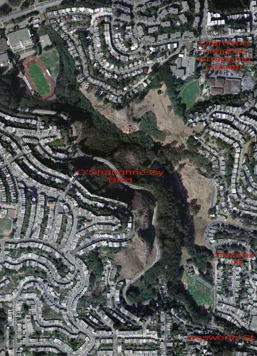
The image is based on a natural-color photograph produced by the U.S. Geological Survey, and made available through the TerraServer website. It corresponds to longitude -122.443 and latitude 37.74079 . The image is part of the natural color data-set known as "UrbanArea" data. This data-set is 1 foot resolution data and will cover approximately 133 major U.S. cities when it is complete.
The text overlays are by Wikipedia Commons user user:easchiff; the combined work is in the public domain.
[edit] Licensing
| This image is in the public domain because it contains materials that originally came from the United States Geological Survey, an agency of the United States Department of Interior. For more information, see the official USGS copyright policy |
|
File history
Click on a date/time to view the file as it appeared at that time.
| Date/Time | Dimensions | User | Comment | |
|---|---|---|---|---|
| current | 00:59, 6 May 2007 | 516×713 (204 KB) | Easchiff | (The photograph in this image was produced by the U.S. Geological Survey, and made available through the [http://terraserver-usa.com/about.aspx?n=AboutAboutImages TerraServer] website. It corresponds to longitude -122.443 and latitude 37.74079 . The text ) |
File links
Metadata
This file contains additional information, probably added from the digital camera or scanner used to create or digitize it. If the file has been modified from its original state, some details may not fully reflect the modified file.
| Orientation | Normal |
|---|---|
| Horizontal resolution | 96 dpi |
| Vertical resolution | 96 dpi |
| Software used | ACD Systems Digital Imaging |
| File change date and time | 05:47, 5 May 2007 |
| Y and C positioning | 1 |
| Exif version | 2.2 |
| DateTime subseconds | 154 |

