Image:GirondePays.png
From Wikipedia, the free encyclopedia
Size of this preview: 600 × 600 pixels
Full resolution (2,139 × 2,139 pixels, file size: 559 KB, MIME type: image/png)
| | This is a file from the Wikimedia Commons. The description on its description page there is shown below.
|
[edit] Summary
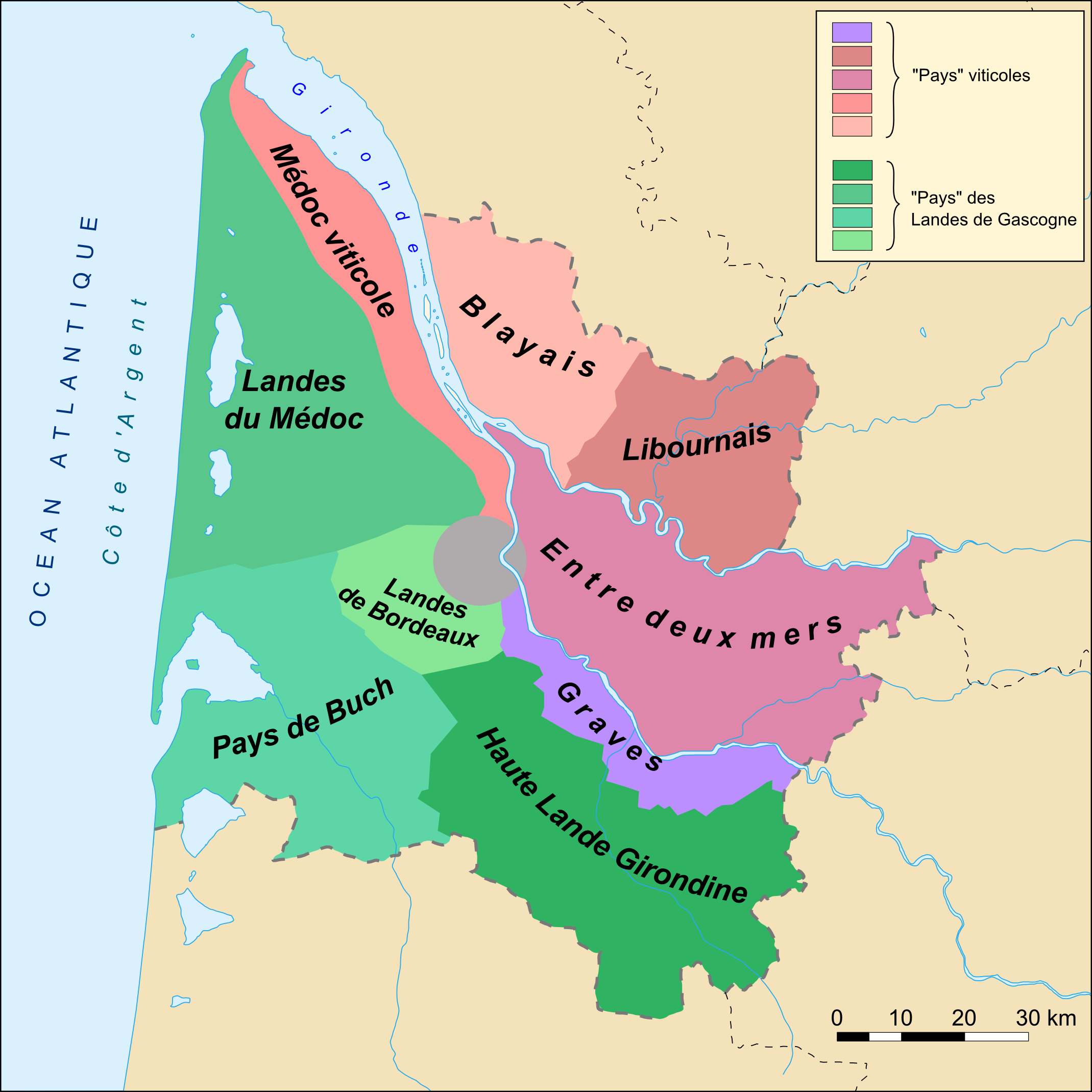
Carte des "pays" du département de la Gironde (33)
[edit] Catégory
[edit] Licensing
| This file is licensed under the Creative Commons Attribution ShareAlike 2.5 License. In short: you are free to share and make derivative works of the file under the conditions that you appropriately attribute it, and that you distribute it only under a license identical to this one. Official license |
File history
Click on a date/time to view the file as it appeared at that time.
| Date/Time | Dimensions | User | Comment | |
|---|---|---|---|---|
| current | 20:15, 11 November 2007 | 2,139×2,139 (559 KB) | Larrousiney | (== Summary == Carte des "pays" du département de la Gironde (33) ==Catégory== Category:Maps of Gironde Category:Wines of Bordeaux Category:Landes de Gascogne == Licensing == {{cc-by-sa-2.5}}) |
| 20:13, 11 November 2007 | 1,750×1,921 (441 KB) | Larrousiney | (== Summary == Carte des "pays" du département de la Gironde (33) ==Catégory== Category:Maps of Gironde Category:Wines of Bordeaux Category:Landes de Gascogne == Licensing == {{cc-by-sa-2.5}}) | |
| 23:54, 10 November 2007 | 2,139×2,139 (558 KB) | Larrousiney | (== Summary == Carte des "pays" du département de la Gironde (33) ==Catégory== Category:Maps of Gironde Category:Wines of Bordeaux Category:Landes of Gascony == Licensing == {{cc-by-sa-2.5}}) | |
| 22:50, 21 October 2006 | 1,750×1,921 (429 KB) | Mtu33260 | (Carte des "pays" du département de la Gironde (33) ==Catégory== Category:Gironde) |
File links
The following pages on the English Wikipedia link to this file (pages on other projects are not listed):

