Image:Gilarivermap.png
From Wikipedia, the free encyclopedia
No higher resolution available.
Gilarivermap.png (499 × 500 pixels, file size: 382 KB, MIME type: image/png)
| | This is a file from the Wikimedia Commons. The description on its description page there is shown below.
|
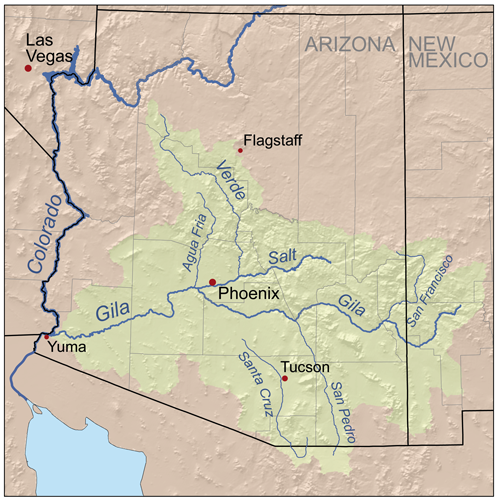
| Description |
Map of the Gila River watershed. |
|---|---|
| Source |
Self-made, based on USGS data. |
| Date |
September 13, 2007 |
| Author | |
| Permission (Reusing this image) |
see below |
|
File history
Click on a date/time to view the file as it appeared at that time.
| Date/Time | Dimensions | User | Comment | |
|---|---|---|---|---|
| current | 18:48, 13 September 2007 | 499×500 (382 KB) | Kmusser | ({{Information |Description=Map of the Gila River watershed. |Source=Self-made, based on USGS data. |Date=September 13, 2007 |Author= Kmusser }} {{self|cc-by-sa-2.5}} [[Category:Maps of rivers of the Unite) |
File links
The following pages on the English Wikipedia link to this file (pages on other projects are not listed):

